Pubs of Manchester

All pubs within the city centre and beyond.
A history of Manchester's hundreds of lost pubs.

Friday 30 September 2011

160. Hardy's Well / Birch Villas, Wilmslow Road

Hardy's Well, Wilmslow Road. (c) fromrusholmewithlove at tumblr.

Perhaps better known to football supporters and locals as the Birch Villas, this pub was renamed after the Hardy's Crown Brewery of Hulme which still has its lettering prominent on the roof.  Hardy's Well had been closed for a while earlier this year but we're pleased to report it's reopen and doing superb trade thanks to its simple policy of serving a good selection of decent beer (e.g. Copper Dragon Golden Pippin) in a convivial atmosphere.


Hardy's Well, Wilmslow Road, Rusholme. (c) Google 2011 - View Larger Map.

Since MCFC moved away, and even before they did, the pub often felt a bit too studenty to attract a proper mixed crowd, but these days it seem to have managed it.  As well as pub crawlers, Hardy's attracted students, families and a good mix of old and younger locals.  Unlike its neighouring old pubs, the Whitworth and Albert, there looked to be a few pre-Curry Mile diners in as well.

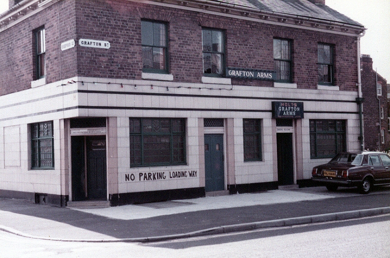
Hardy's Well, Wilmslow Road. (c) Brewery History.

As one of only three of the traditonally-thought of Maine Road boozers left (the Albert and Claremont being the others), it's great to see the old Birch Villas open again and doing well.  The telephone box in the beer garden and poem on the whitewashed wall are a nice touch as well, particularly as the latter is from local poet, Lemn Sissay.


Hardy's Well, Wilmslow Road. (c) Dr Tony Shaw.

159. Albert Inn, Walmer Street

Albert, Walmer Street, Rusholme. (c) eevee.

The Albert Inn is one of the few old and much-loved Maine Road boozers that is still open, and thankfully, is just as good as the old times. Tucked away on the corner of Walmer Street and Aspinall Street off Wilsmslow Road, it's a classic local's pub that seems to be doing alright since the football custom left Rusholme and Moss Side.


Albert Inn, Walmer Street. (c) Google 2011. View Larger Map.

The Albert is a classic Victorian pub with old fashioned clientele to match.  Elder folks from the nearby Rusholme and Moss Side estates are mixed with a younger crowd of locals, yet despite its prime position just off the Curry Mile, didn't appear to have any diners in on a Saturday night.

Albert Inn, Walmer Street, Rusholme. (c) Pubs of Manchester.

The Albert is a tied Hydes house, but when the bitter is as good as Hydes can be, and is brewed so close by (the brewery is barely a mile away - EDIT: it's since moved to Salford Quays), sometimes a row of guests ales aren't needed in decent boozers like this.  Normal bitter, the premium version (1863) and a keg mild is enough for the bar which straddles the lounge and vault.


Albert Inn, Walmer Street, Rusholme. (c) Pubs of Manchester.

The inside is like all good pubs should be, and once were.  Bench seating with low stools and them hammered copper tables that seem to have all-but vanished from English pubs.  All that was missed were the ashtrays.  The pool room vault is still going and although they've modernised slightly with a flatscreen TV, it's still a proper throwback pub.


Albert Inn, Walmer Street, Rusholme. (c) Pubs of Manchester.

As more people are starting to realise, pubs are on their arses in general, and the great British local pub as we know it is dying thanks to - amongst others - modern entertainment and social media, scandalous taxation, disingenuous public health campaigns, and greedy and clueless pub companies.  Thankfully Manchester still has a number of proper boozers that should never die, and the Albert is hopefully one.

158. Whitworth, Moss Lane East

Whitworth, Moss Lane East, Rusholme. (c) Manchester Scene Wipe.

The Whitworth was an old boozer we'd been looking forward to visiting after about a decade.  Situated opposite Whitworth Park and at the very start of the Curry Mile, this was a popular match day pub where drinkers could chose between the traditional interior or standing outside on the pavement.  Sadly, the pub has had a refurb which has ripped out the character it once had, and the once well-kept range of Marstons's beers have been replaced by a couple of lacklustre and badly served cask ales.  The pint one of us ordered was so cold it came out with bubbles on the glass and to compound the problem, was also unsparkled.  A fall-back of Newcy Brown was swiftly requested for supping on the admittedly excellent rear terrace.


Whitworth, Moss Lane East, Rusholme. (c) Google 2011. View Larger Map.

For a Saturday night this place was almost empty and compared to the price and quality of drinks nearby at the Ford Madox Brown or Albert, it's plain to see why.  Unfortunately, the Whitworth may not not survive without a rethink.  With the ubiquitous students, the Curry Mile still drawing in diners, plus the closure of the Clarence, there is room for a decent pre-curry boozer here, but in its current state it won't attract too many casual visitors back.  UPDATE:  As we hated to predict, as of 2012 the Whitworth has gone, and has been converted into a coffee shop, the Anchor Coffee House.


Former Whitworth, Moss Lane East. (c) Anchor Coffee.

Mile House, North Road

Mile House, North Road, Cheetham Hill. (c) BBC News.

The Mile House was one of Manchester's very oldest pubs, dating back to 1731 and was 271 years old when it was sadly demolished in 2003. Shown here in 1966 and 1971 this traditional Boddington's house was once used as a makeshift morgue but was better known for its more recent links to the Irish community thanks to the last landlord, Tommy Gaffney (above).  He served many Manchester mayors and their Dublin counterparts, as well as local celebrities such as Ricky Tomlinson, and famously thirsty Coronation Street stars, Phil Middlemiss and Bruce Jones.  The Mile House was compulsory-purchased by the ever-respectful Manchester City Council to be replaced by a warehouse and retail complex [1].  The boozer once stood on North Street, Cheetham Hill, which is a continuation of Red Bank, and in place of the Mile House is this ugly rear of a Shopping Centre unit and a pub-sized piece of scrub land.

Former location of Mile House, North Road, Cheetham Hill. (c) Google 2011 - View Larger Map.

Wednesday 28 September 2011

Apollo, Varley Street

Apollo, Varley Street, Miles Platting. (c) Google 2011 - View Larger Map.

Another of Miles Platting's estate pubs to close, the Apollo only closed in 2010 but looks unlikely to reopen any time soon.  It is situated on Varley Street at the Oldham Road end, on the corner of Farnbrough Road in the shadow of a high-rise.  Like many of Manchester's inner city estate pubs, the Apollo has been blighted by trouble and gangs over the years, but this summer an odd crime was reported at the pub - some enterprising young thief nicked the paving stones from out the front [1].  There is a picture of the boarded up Apollo at the Manchester Evening News / North West Advertiser site.

1. http://menmedia.co.uk.

Hat & Feathers, Varley Street

Hat & Feathers, Varley Street, Miles Platting. (c) Google 2011 - View Larger Map.

This Miles Platting estate pub sat on the corner of Varley Street and Sandal Street, just off Bradford Road, in a now decimated part of north-east Manchester.  The side of the pub is shown here partly in 1967 in happier and busier times for 'The Platting', as the area is known locally.  The area is actually named after a platting, or bridge / culvert, which once crossed the old road into Manchester near here.  The Hat & Feathers building still stands according to googlemaps and has been used as a family charity base for some time until they moved out in 2008 [1].  Another of Manchester's unloved estate pubs; gone and almost forgotten. 

Monday 26 September 2011

Robert Tinker, Dalton Street

Robert Tinker, Dalton Street, Collyhurst, 1992. (c) Alan Winfield with kind permission.

A mile or so north east of the city centre in Collyhurst, the Robert Tinker was another estate pub that once served an underprivileged little housing area off Rochdale Road.  It was named after the chap who founded Vauxhall Gardens here in the late 1700s, an attraction which was recorded in the main entrance of the estate pub in the form of an 1820s reproduction poster announcing "ROBERT TINKER'S VAUXHALL PLEASURE GARDENS [1]. 


Robert Tinker, Dalton Street, Collyhurst. (c) Bob Potts [1].

The Robert Tinker opened in 1967 as a Wilsons house but by the 1990s had already become a rundown, decrepit sight as a Banks's pub, although Alan Winfield reported it being smarter than expected inside with two real ales on offer (Banks's Bitter and Mild). 


Former location of Robert Tinker, Dalton Street, Collyhurst. (c) Google 2011. View Larger Map.

1. The Old Pubs of Rochdale Road and neighbourhood Manchester, Bob Potts (1985). 

Bridge, Regent Road


Bridge, Regent Road, Salford. (c) Neil Richardson [1].

The Bridge Hotel opened on the corner of Ordsall Lane and Bridge Street in the early 1840s and by the 1890s it was a Groves & Whitnall house.  The brewery later gave it their distinctive ornately tiled frontage.  The Bridge held concerts in its music hall, advertising a "spacious and attractive dining pavilion" which was "just the place for mechanics and other workers to get a good meal at a reasonable price [1]."  The pub was looking tired by the 1980s following the widening of Regent Road and by 1985 it had closed before being knocked down two years later.  Today the Campanile Hotel restaurant sits on this corner close to the Regent Road bridge and the inner ring road.

Former location of the Bridge, Regent Road, Salford. (c) Google 2011 - View Larger Map.

1. Salford Pubs - Part Two: Including Islington, Ordsall Lane and Ordsall, Oldfield Road, Regent Road and Broughton, Neil Richardson (2003).

Wellington, Regent Road

This notorious boozer was closed this month following shooting of a drinker during a Saturday night-late 3am lock-in.  Due to its prior bad reputation for attracting criminals, the Wellington had been closed for a while before reopening in 2011 under strict conditions, such as CCTV inside the pub and a buzzer system for entry [1].


Wellington, Regent Road, Salford. (c) Google 2011 - View Larger Map.

These measures didn't stop another murder in one of Salford's estate pubs.  The Wellington has only been standing on this corner of Regent Road and Oldfield Road since September 1986 having been built by Boddingtons Brewery to replace the original Wellington which had stood here since 1829.  It was slightly set back from the main road to the left and had a single-storey extension built to the pavement in the 1870s [2].

The original Wellington, Regent Road, Salford. (c) Neil Richardson (2003).

By the early 1900s the Wellington was a Boddingtons house.  In the late 1970s, then licensee, Len McMullen, discovered a load of interesting memorabilia in the attic of the pub such as beer bills from Joules Brewery and the Regent Road Brewery from the 1840s, wines and spirits receipts from Manchester merchants, and malt and hops bills, proving that beer was once brewed on the premises.  These have been deposited in the Salford City Council archives [2].

In the early '80s, road widening meant the original Wellington had to be pulled down, and the new pub was built set back and slightly to the right, nearer Oldfield Road.  The old pub closed in June 1986 and by September the new Wellington was open [2].  As well as the murder, there have been reports of open drug taking in the pub, so it's a sure fire bet that the Wellington will never reopen.

1. http://menmedia.co.uk/manchestereveningnews.
2. Salford Pubs - Part Two: Including Islington, Ordsall Lane and Ordsall, Oldfield Road, Regent Road and Broughton, Neil Richardson (2003).

Sunday 25 September 2011

Irwell Castle, Great Clowes Street


Former Irwell Castle, Great Clowes Street, Lower Broughton. (c) Google 2011 - View Larger Map.

The Irwell Inn opened at the bottom of Great Clowes Street near Broughton Bridge in the 1850s, becoming a Manchester Brewery Company house by the early 1900s.  The brewery gave the exterior of the pub a makeover to match the Victoria Theatre next door by adding tiling, imitation columns and balustrades and three ornate pediments to the roof, each containing carvings depicting Castle Irwell which had stood where the nearby racecourse was [1].


Irwell Bridge, Great Clowes Street, Lower Broughton. (c) Neil Richardson [1].

By now the pub was known as the Irwell Castle and only in 1960 did then owners Wilsons Brewery remove the grand frontage giving it the plain rendering we see today on the closed pub [1].  It's been shut since 1992 and appears to now be a couple of houses.

1. Salford Pubs - Part Two: Including Islington, Ordsall Lane and Ordsall, Oldfield Road, Regent Road and Broughton, Neil Richardson (2003).

Original, Lower Broughton Street

The Original, Lower Broughton Road, Lower Broughton. (c) Neil Richardson [1].

The Original was at the bottom end of Lower Broughton Road on the corner of Harrison Street, the lower end of which has been replaced by the car park of the grim and weirdly-named Mocha Parade shopping centre.  In the 1860s the pub opened as a beerhouse and was owned by Walkers & Homfray by the early 1900s.  The brewery built a new Original pub with a small tower on the corner.  After WWII the Original became a Wilsons house and remained so until its closure in 1976 [1].  By then, most of the surrounding property in this part of Lower Broughton near the River Irwell and Broughton Bridge had been pulled down.  The pub soon followed in an attempt at regeneration of the area.

Former location of the Original, Lower Broughton Road, Lower Broughton. (c) Google 2011 - View Larger Map.

1. Salford Pubs - Part Two: Including Islington, Ordsall Lane and Ordsall, Oldfield Road, Regent Road and Broughton, Neil Richardson (2003).

157. Ford Madox Brown, Oxford Road

Ford Madox Brown, Oxford Road. (c) Wetherspoons.

The newest of central Manchester's Wetherspoons, the Ford Madox Brown is named after the artist who lived locally in Victoria Park and whose paintings are still exhibited today in the Whitworth Art Gallery.  Like most Spoons (the Moon Under Water and Piccadilly aside), it is busy, basic and cheap, the beer is generally okay, and the clientèle is a mixed bag of youngsters and enthusiastic soaks enjoying the cheap beer.  A handful of casks ales were on offer although nothing of real interest to the connoisseur.  It was interesting chatting to an old chap who surprisingly said that this was his 'local'.  Despite there being better options nearby, the low Wetherspoons prices were the main attraction.  

Ford Madox Brown, Oxford Road. (c) Wetherspoons.

156. Varsity, Hathersage Road


Varsity, Hathersage Road. (c) Google 2011 - View Larger Map.

Despite its superb location opposite Whitworth Park on the corner of Hathersage Road and Oxford Road, Varsity is a pretty nondescript new-build bar beneath the oddly named Wilmslow Park student flats - surely it should have been named after the park, the Art Gallery and Joseph himself?  It was a nice surprise to see a real ale on offer in here, even if was only the rather standard English Pale Ale (EPA) from Marstons.  The older Varsity down the road on Oxford Street has recently morphed in Alibi, but both bars remain student places that serve a purpose but hold little appeal for seasoned drinkers.

155. Oxford, Oxford Road


The Oxford, Oxford Road. (c) Google 2011 - View Larger Map.

The first in a stretch of unappealing new-build student pubs along Oxford Road, this former Hogshead wasn't that bad in terms of ale on offer.  Four hand-pulls were on, and even if the selection was a bit uninspiring, the ale wasn't in bad nick.  It's a Stonegate pub company house, with faux 'ye olde' decor within.


The Oxford, Oxford Road. (c) Pubs of Manchester.

As would be expected, The Oxford attracts mainly students due to the reasonable prices - £2.19 for the dull Bombardier and £6.95 for two pub meals.  So, there's nothing inspiring about this one, but nothing too wrong with what they're doing.  Think I'd have preferred the original Oxford though, down the road.

Thursday 22 September 2011

Grove, Every Street


Grove, Every Street, Ancoats, 1950s. (c) Neil Richardson [1].

The Grove was on the corner of Ancoats Grove and Every Street just off Great Ancoats Street, and it was the last of Every Street's pubs to be lost in 1981.  It opened in 1857 as a Pollard Street house then Wilsons had it, as shown here in 1970.  It had a terrible reputation and was nicknamed "the Dirty Shame [1]."


Former location of Grove, Every Street, Ancoats. (c) Google 2011 - View Larger Map.

1. The Old Pubs of Ancoats, Neil Richardson (1987).

Spread Eagle, Every Street

Spread Eagle, Every Street, Ancoats, 1930s. (c) Neil Richardson [1].

The Spread Eagle was the oldest pub of Every Street in Ancoats, dating back to the 1820s when it opened opposite the All Saints Church.  Shown here in 1963 on the corner with the lost Holme Street, the Threlfalls house closed a few years later in 1967 [1].  Wide grass banking runs this length of Every Street today.

Former location of Spread Eagle, Every Street, Ancoats. (c) Google 2011 - View Larger Map.

1. The Old Pubs of Ancoats, Neil Richardson (1987).

Plymouth Grove, Plymouth Grove


Plymouth Grove, Plymouth Grove. (c) Aidan O'Rourke.

The Plymouth Grove is a contender for Manchester's most magnificent pub building, even though it is rotting away, less than a mile south-east of the city centre, in close proximity to the hospitals and universities. Built in 1873-74, it is a monument to Victorian splendour, it once sat on the corner of Shakespeare Street, now the less-romantic Leigh Street.

The Plymouth Grove has been shut maybe a decade, and despite its Grade II listed status, has been allowed to slowly disintegrate with its internals surely too far gone to ever hope of refurbished.  In 2005 there were stories of feverish interest over its £380,000 price tag in the local papers but nothing appears to have come of that.

Plymouth Grove, Plymouth Grove. (c) Google 2011 - View Larger Map.

Once a Boddington's tied house, the Plymouth Grove was a multi-roomed boozer with traditional bench seating and an older clientèle from the nearby estates.  This area of Ardwick around Plymouth Grove is still full of superb Victorian architecture that much of Manchester seems to have forgotten about.

The Plymouth Grove's ornate clock tower, columns and carvings look set for the wrecker's ball unless someone rapidly snaps it up to prevent Mother Nature and her pigeons from seeing it off.  An outside chance is that a property developer sees an opportunity to convert this magnificent old building into apartments.  More like likely is that developers such as Grove Village will buy it to get rid of it then build poor quality student accommodation in its place.

Check out in the external shots from Bignickb at Derelict Places and internals from El Juako at 28dayslater.

Wednesday 21 September 2011

Grey Mare, Varley Street

The Grey Mare was a Burtonwood house on Varley Street, off Oldham Road in Miles Platting, north west of Eastlands.  It was an ugly box-shaped estate pub which had been here since the 1960s, as shown here as a Tetley's house in 1963.  There is a close-up of the Grey Mare at Manmates.  The modern Grey Mare closed in 2000 but it may have replaced an older pub that stood here of the same name.  No doubt knocked down for the purpose of regeneration, predictably, nothing has been done with this site.  There is a photo of the Grey Mare by Alan Winfield at Pubs Galore.


Former location of Grey Mare, Varley Street, Miles Platting. (c) Google 2011 - View Larger Map.

Blackstock, Upper Brook Street

The Blackstock was a huge, multi-roomed boozer on the corner of Upper Brook Street and Blackstock Street.  These days the pub operates as a computer shop, but as recently as the 1990s it was a Whitbread-tied house offering a couple of real ales [1].  


Blackstock, Upper Brook Street. (c) Google 2011 - View Larger Map.

Despite being in a relatively under-pubbed area, close to thousands of students and hospital works, as well as the Ardwick and Chorlton-on-Medlock estates, the Blackstock has been closed for a over a decade.  At least the building has found a use, unlike the listed yet rotting Plymouth Grove nearby.  There is a photo of the Blackstock by Alan Winfield at Pubs Galore [1].

1. www.pubsgalore.co.uk/areas/chorlton-upon-medlock/greater-manchester.

Grafton Hotel / Gallery Bar, Grafton Street

Gallery Bar, Grafton Street. (c) Adam B. at flickr.

The Gallery Bar was part of the Grafton Hotel, just off Oxford Road, but as the sign shown above said, it was open to non-residents.  I did have a late pint in here once with some Scandinavian types on the eve of a match in the late '90s, but recall little of it apart from the dinginess.  It reputedly served real ale in more recent times.  The hotel was set in some fine-looking Edwardian townhouses, although inside the facilities left much to be desired when compared to modern hotels, as a search on the hotel review sites confirms.  The buildings were knocked down with the justification that the rooms weren't up to modern standards and to renovate would be too costly.  

Grafton Hotel, Grafton Street. (c) Adam B. at flickr.

Monday 19 September 2011

Brass Tally, Liverpool Street


Former location of Brass Tally, Liverpool Street, Salford. (c) Google 2011 - View Larger Map.

Yet another, but probably the last of the lost Salford Precinct estate pubs, the Brass Tally was built for Greenall Whitley's on the corner of Westerham Avenue and Liverpool Street.  It was situated in front of the row of shops and the Salford Arts Theatre, opening in August 1978 and closing in 1993 [1].  As detailed in an extract from Salford LifeTimesLink [2], Greenall Whitley settled on the Brass Tally after considering 'Lala's Laughing Fox', 'Mark Addy', 'Ensign Ewart' and the 'November Handicap' [1].  A sadly familiar patch of empty land is all that's left of the Brass Tally these days.

1. Salford Pubs - Part Three: Including Cross Lane, Broad Street, Hanky Park, the Height, Brindleheath, Charlestown and Weaste, Neil Richardson (2003).
2. www.salford.gov.uk/d/issue15.pdf.

Brass Handles, Edgehill Close

The Brass Handles estate pub was built for Whitbread's in 1975 on Edgehill Close, off Fitzwarren Street, south of Salford Precinct.  Sadly, it is probably best known for the high-profile execution of two gangsters who were killed following a failed hit-job in March 2006.  

Brass Handles, Edgehill Close, Salford. (c) dailymail.

They had walked into the Brass Handles, opened fire on two blokes watching the United match, and as they fled, were themselves both shot dead on the grass outside the pub where children were playing [1].  The fatal shots were apparently fired from a hitman's weapon by an anonymous drinker.

Brass Handles, Edgehill Close, Salford, 2006. (c) MEN.

Following the shootings, the Brass Handles was closed by GMP and never reopened.  Shown below boarded up and then for sale, it has recently been bulldozed, leaving just two Salford Precinct estate pubs surviving, the Flemish Weaver (once known as Salford's drug store) and the Winston (known to locals as the 'Fraggle Rock').  The Brass Handles is shown at flickr by deltrems.

1. http://news.bbc.co.uk/1/hi/uk/6549873.stm.

Mariner, Liverpool Street


Former location of the Mariner, Liverpool Street, Salford. (c) Google 2011 - View Larger Map.

The Mariner was yet another estate pub built to cater for the redeveloped Precinct area in Salford, sitting on the corner of Liverpool Street and Athole Street.  It was built for Wilsons Brewery, opening in December 1976 under Harry and Jean Cole.  The pub was almost named 'The Lowry' or 'The Liner' by the brewery but they settled on the Mariner, a name that "...sets out to preserve the warmth and tradition long associated with Salford's seaport taverns of old.  A colourful portrait of a pipe-smoking sea dog hangs over the door [1]."

The Mariner lasted until 2000 until it was bought by Salford City Council.  The following meeting minutes tell the sorry story of why the pub was demolished: 

"...Councillors... hereby approve:  The demolition of The Mariners Public House on Liverpool Street, Salford 6.  The reasons are:  To facilitate Urban Renewal in the Seedley & Langworthy area...  The Partnership purchased the Mariner in March 2001, at a cost of £34000 (£32500 OMV plus £1500 fees) with funds made available from the NWDA.  A condition of the grant from the NWDA is that the building be demolished by June 2001 [2]."

Predictably, in the ten years since the decision was made to demolish the Mariner, nothing has been done with the site.  There is a photo of the Mariner at flickr from "Salford Pubs of the 70s" - what an ugly yet superb example of an inner-city estate pub.

1. Salford Pubs - Part Three: Including Cross Lane, Broad Street, Hanky Park, the Height, Brindleheath, Charlestown and Weaste, Neil Richardson (2003).
2. http://services.salford.gov.uk.

Sunday 18 September 2011

154. Grafton Arms, Grafton Street


Grafton Arms, Grafton Street. (c) Adam B. at flickr.

This Joseph Holt's house halfway down Grafton Street at the entrance to the Manchester Royal Infirmary is a fairly new-build local's pub, despite being in student-land.  The original Grafton Arms, shown below, was for some reason replaced by Holt's despite being a fine-looking establishment.

Grafton Arms, Grafton Street. (c) mikejackson

The new Grafton Arms is a typical two-roomed modern boozer - a large lounge and vault with a central bar.  The usual Holt's ales were offer, but unfortunately, neither the Bitter nor the IPA were in particularly good nick, although the scattering of locals in here on a Saturday afternoon seemed happy enough supping it.  A decent back yard for the smokers ironically overlooks the hospital entrance.

The Grafton Arms is a bit of a throwback sort of place, with lone old gents, a couple of chaps betting, and a rowdy mixed group of locals, giving it an estate pub feel.  Inside there are some superb pictures hung; most of them drawings of central Manchester locations, including fellow Holt's new-build, the Old Monkey.  The advertised karaoke at 9pm was temping, but alas we had places to be.


Grafton Arms, Grafton Street. (c) Pubs of Manchester.

The neighbouring Bowling Green has sadly closed and the Grafton Hotel on the other side of Grafton Street has been demolished.  The future of the Grafton Arms is uncertain, but let's hope it survives, with a combination of loyal locals, the odd bunch of brave students, not forgetting patients and their visitors nipping out for a quick scoop.


Grafton Arms, Grafton Street. (c) Adam B. at flickr.

153. Big Hands, Oxford Road

Big Hands is a strange little bar housed in a 1970s box unit that it shares with a flower shop on Oxford Road opposite the hospital.  Back in the day this housed Champers Wine Bar, which resembled more of a lock-up than a bar.  These days it looks a bit more inviting and there's even a tiny alfresco drinking area outside, albeit one without chairs, just high tables to lean against while you watch the students traipsing up and down Oxford Road.  Inside it's dark and cluttered but to be fair, their much-vaunted rock 'n' roll vibe seems present and it gets rammed before and after gigs in here.


Big Hands, Oxford Road. (c) Google 2011 - View Larger Map.

No real ale on cask in here as might be expected, but at least they had a few bottled ales in the fridge - Black Sheep, bottle-conditioned Bluebird and Taylor's Landlord.  Continential lager appears to be the order of the day in there with an impressive selection on the bar and in the fridge.  Apparently local faces such as Elbow and Badly Drawn Boy are known to drink in Big Hands if celebrity spotting is your thing. Alternatively, stand outside and peer up Grafton Street, wonder what the Bowling Green was like and what delights the Grafton Arms may hold.

152. Sandbar, Grosvenor Street


Sandbar, Grosvenor Street. (c) Google 2011 - View Larger Map.

Sandbar on Grosvenor Street consists of two old Georgian houses knocked through to form a ramshackle bar that we missed out on last time we were down this end of town.  That was down to the odd policy of not opening until 3pm on Saturdays.  However, as the starting point of a Chorlton-on-Medlock to Rusholme crawl it was pleasant one with the Copper Dragon best bitter - one of three real ales - a decent pint at three quid.  Sandbar's dark frontage is matched inside with several separate seating areas plus a beer yard at the back and benches out the front.

Sandbar, Grosvenor Street. (c) citylife.

It seems to attract the more discerning students (those who know no better will head to the dreadful Footage) and it's well placed for gigs at the Academies.  The renamed Zoo / Pub is a couple of doors down, whilst on the other side it's a mixed bag with a gaming bar, Kyoto Lounge, the Deaf Institute and the Footage (the old Footage & Firkin, which we nipped into but swiftly exited due to the lack of proper beer).  Sandbar is comfortably the best of the Grosvenor Street pubs, even if it has lost its sign of late.

Website:  www.sandbaronline.net.

Saturday 17 September 2011

Ship, Eccles New Road


Ship, Eccles New Road, Salford, 1951. (c) Neil Richardson [1].

Technically Eccles New Road, the Ship is usually included when people remember the Cross Lane pubs.  It was a huge, imposing corner pub built in 1888 to replace the Turf Tavern beerhouse which had stood on the corner of Eccles New Road and Cross Lane since 1868.  The Ship Hotel was named after the Manchester Ship Canal and was taken by Walkers & Homfray.  Concerts were advertised every night, "Everything in good taste. Nothing offensive. Nothing vulgar or rowdy" and the Ship was known as "The Winter Garden of Salford."  By the 1960s it was a Wilsons pub and it closed in 1973, a few years before the Regent Road roundabout and M602 arrived [1].

1. Salford Pubs - Part Three: Including Cross Lane, Broad Street, Hanky Park, the Height, Brindleheath, Charlestown and Weaste, Neil Richardson (2003).

Sportsman, Cross Lane

Sportsman, Cross Lane, Salford (No.10). (c) Neil Richardson [1].

The Sportsman (No.10 above) was a small beerhouse a few doors down Cross Lane from the Corporation (7), Drovers (8), and opposite the Grapes (1), Fusiliers / Paddock (9) and Butchers Arms (4).  It was first called the Original Three Pigeons Inn in the 1850s.  By the early 1900s the Manchester Brewery were the owners and Sportsman eventually closed in 1928 [1].


Former location of Sportsman, Cross Lane, Salford. (c) googlemaps.

1. Salford Pubs - Part Three: Including Cross Lane, Broad Street, Hanky Park, the Height, Brindleheath, Charlestown and Weaste, Neil Richardson (2003).

Butchers Arms, Cross Lane

Butchers Arms, Cross Lane, Salford. (c) ssplprints.

The Butchers Arms was on the corner of Unwin Street (now Churchill Way) at the top end off Cross Lane in between the Grapes and the Cattle Market Hotel.  First licensed in 1840, the Butchers advertised "the largest pig hog in the world" in 1867 - many pubs around Cross Lane would display freak animals that had come to the cattle market to draw in customers.  The pub was taken by Cardwell's Brewery in 1894 then Wilsons in 1899, Groves & Whitnall in 1907 then the North Cheshire Brewery in 1917.  In December 1922 the Butchers advertised"free wireless demonstrations", as pictured above. The pub closed before most of its Cross Lane neighbours, in 1967 under final owners, Inde Coope [1].

Former location of Butchers Arms, Cross Lane, Salford (Corporation, right). (c) googlemaps.

1. Salford Pubs - Part Three: Including Cross Lane, Broad Street, Hanky Park, the Height, Brindleheath, Charlestown and Weaste, Neil Richardson (2003).

Church Inn, Cross Lane


Church Inn, Cross Lane, Salford, 1974. (c) Arthur Brougham with family's permission.

The Church Inn was in a row of shops, three doors from Regent Road at the bottom end of Cross Lane, opposite the old Palace Theatre.  It started out as a shop but in the 1860s, shopkeeper Matthew Bradshaw obtained a beer retailers licence.  Towards the end of the century the Church Inn comprised a front room vault, parlour behind with kichen and scullery to the rear.

Church Inn, Cross Lane, 1974. (c) NAH1952 at flickr.

The milk shop next door was incorporated and in 1906 a smoke room extension was added in the back yard by owners, the Rochdale & Manor Brewery who surrendered their licence at the Tyrone Castle, Arlington Street for these improvements.  By the 1960s Sam Smith's Brewery owned the Church, but along with its neighbours - the Wellington across the road, the Railway, the Station etc - it was pulled down in 1979.


Church Inn, Cross Lane, late 1970s. (c) Neil Richardson [1].

1. Salford Pubs - Part Three: Including Cross Lane, Broad Street, Hanky Park, the Height, Brindleheath, Charlestown and Weaste, Neil Richardson (2003).

Station, Cross Lane


Station (left), Cross Lane, Salford, 1974. (c) NAH1952 at flickr.

The Station was next door-but-one to the Railway on Cross Lane adjacent to the railway bridge, opposite the old Cross Lane Station. The pub started out as the Star Inn in about 1850 and was (misleadingly) advertised as "an old original beerhouse" in 1858 [1]. Groves & Whitnall took the Star in 1891 and rebuilt it as the Station Hotel in 1898.  It finished its time as a Greenall Whitley house and - like its neighbours - was lost in the Cross Lane pub cull of 1979 due to the Regent Road roundabout construction.

1. Salford Pubs - Part Three: Including Cross Lane, Broad Street, Hanky Park, the Height, Brindleheath, Charlestown and Weaste, Neil Richardson (2003).

Friday 16 September 2011

Church Inn / Blue Moon, Clayton Lane


Blue Moon, Clayton Lane, Clayton. (c) lucky stewart at sports.webshots.com.

The Church Inn had one last attempt at making a go of it in this deprived part of inner city East Manchester that's had much of its heavy engineering industry and housing ripped from it.  When MCFC moved from South Manchester to East in 2003, the Church was renamed the Blue Moon and did reasonable match day trade, but it sounds like that was about it.  Like in the 1990s, the pub was keg-only, although going back further it was a rare Bass pub serving cask Mild by electric dispense [1].  The Blue Moon was pulled down at the end of 2007 [2], a few years too early before the Abu Dhabi investment transforms this part of town.


Former location of Church Inn, Clayton Lane, Clayton. (c) googlemaps.

1. www.pubsgalore.co.uk/pubs/25811/.
2. http://manmates.proboards.com/.