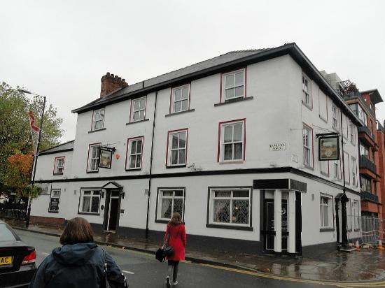
Pubs of Manchester

All pubs within the city centre and beyond.
A history of Manchester's hundreds of lost pubs.

Wednesday 31 March 2010

Woodmans Hut, Great Ancoats Street

The Woodmans Hut beerhouse sat in between the Sheffield Arms and Moulders Arms on this part of Great Ancoats Street between the Rochdale Canal and the Retail Park.  It's thought it opened a couple of years after the Sheffield Arms shut in 1840.  Thomas Bake was the beerhousekeeper in 1845 and it was last mentioned in the directory in 1869.  An 1849 advert describes the Woodmans as "commodious and eligible for carrying on an eating-house together with the beer trade [1]."  A significant-sounding meeting was held here in 1846: "A meeting of delegates from the Short Time Committee of Lancashire and Cheshire was held at the Woodmans Hut, January 24th 1846, at which petitions were set of foot praying for a Ten Hours Factory Bill for five days in the week and eight hours on Saturday [2]."

1. The Old Pubs of Ancoats, Great Ancoats Street (1987).
2. The Annals of Manchester: A Chronological Record From the Earliest Times to the End of 1885, William E. A. Axon (year unknown).

Prince of Wales Feathers, Great Ancoats Street


Former location of Prince of Wales Feathers, Great Ancoats Street. (c) Google 2010. View Larger Map.

On the corner of Ducie Street (then known as Mather Street) stood the Prince of Wales Feathers, which as early as 1819 was run by John Grisone as a pork butchers and eatery.  He obtained a beerseller's licence in the early 1830s and the next tenant, William Rigby, continued it as a beerhouse-cum-restaurant.  It lasted until the 1890s when Watson Dyson turned it into a tripe shop and surrendered the beer licence.  UCP (tripe specialists, see Tavern entry) took over the shop and the building survived until the 1950s [1] before being demolished and now a furniture showroom stands on the site.

1. The Old Pubs of Ancoats, Neil Richardson (1987).

Smiths Arms, Great Ancoats Street

Former site of Smiths Arms, Great Ancoats Street. (c) Google 2010. View Larger Map.

One of the first beerhouses on Ancoats Lane (Great Ancoats Street) and named after its founder, Thomas Smith, the Smiths Arms lasted from the 1830s to 1856 when Amelia Oakden last had it before it became a surgery [1].  It was situated on the now lost Bradfield Street on the northern side of Great Ancoats Street, roughly opposite where Millbank Street (then Meadow Street) is now, not far from the Ashton Canal bridge.  The modern but impressive Islington Wharf apartments are sited here, and unbeknownst to non-residents, the development contains a secret garden:

Islington Wharf, Great Ancoats Street. (c) Google 2010. View Larger Map.

1. The Old Pubs of Ancoats, Neil Richardson (1987).

Sheffield Arms, Great Ancoats Street

The Sheffield Arms was a couple of doors up from the Moulders Arms, on the Ancoats Retail Park side of the Rochdale Canal.  It was amongst The Lane's (Great Ancoats Street's) first beerhouses, opening in the 1830s but had become a shop by 1840.  The beerhouse was named after the Sheffield Foundry which was in nearby Store Street [1].

Former location of Sheffield Arms, Great Ancoats Street. (c) Google 2010. View Larger Map.

1. The Old Pubs of Ancoats, Neil Richardson (1987).

Station Inn, Fairfield Street

Former location of Station Inn, Fairfield Street. (c) Google 2013. View Larger Map.

On what is now the Star & Garter's car park used to the stand the Station Inn, a Boddingtons house.  This opened around 1860 and had closed by 1902 [1].  In The Old Pubs of Ancoats, the Star & Garter is shown in less shabby days in the 1960s and the adjoining building on its left is probably the old Station Inn.   Said building can just about be seen here in the 1970s.


Former Station Inn (left), Fairfield Street. (c) Neil Richardson [1].   

1. The Old Pubs of Ancoats, Neil Richardson (1987).

Tuesday 30 March 2010

Bird in Hand, Heyrod Street


Bird in Hand Entry, Heyrod Street. (c) Google 2010. View Larger Map.

The walkway which connects Heyrod Street to Travis Street just east of Piccadilly Station is or was known as Bird in Hand Entry.   It's named after the beerhouse that used to stand at the Heyrod Street corner, as seen above where the small factory is now sited.  The Bird in Hand closed in 1898 [1] but its name lives on, albeit in this forgotten part of town.

Bird in Hand Entry, Travis Street. (c) Google 2010. View Larger Map.

1. The Old Pubs of Ancoats, Neil Richardson (1987).

Brown Bull, Malaga Street


Former Malaga Street, Baird Street end. (c) Google 2010. View Larger Map.

Malaga Street used to carry on from Sparkle Street, linking to Sheffield Street and has been partially built over, but the line of the old street is clearly evident.  The Brown Bull stood on the left here at the Baird Street, Sheffield Street end.  The pub was originally owned by the London & North Western Railway Company.  However, the authorities fought to have it closed, and even the Mayor of Manchester stated that the Brown Bull was too small and ill-suited for business with little bedroom accommodation: "They must take away the worst of these houses."  The railway company wanted to keep it as a watering hole for their workers as it was handy for their dinner time pint.  Sadly the magistrates had their way and the Brown Bull was leased to Kays Atlas Brewery in 1905, who, in turn, immediately surrendered its licence in a deal which benefitted another of their houses [1].

1. The Old Pubs of Ancoats, Neil Richardson (1987).

King William IV / Tacklers Arms, Boad Street

Location of King William IV, Boad Street. (c) Google 2010. View Larger Map.

The King William IV on Boad Street sat in the shadow of London Road Station, today's Piccadilly Station, between Store Street and Sheffield Street.  In the 1850s it had a four-barrel brewhouse and was then known as the Tacklers Arms.  Mike Burke remembers the King Billy as "Harry Horner's: a lot of policemen went in there because there was a police station just under the railway arches."  Horner had the pub from 1916 until it lost its licence in 1925 and was pulled down in 1936 [1].  The plan of the new Ashton-bound Metrolink line below shows Boad Street:

Plan of new Ashton-bound Metrolink line.

1. The Old Pubs of Ancoats, Neil Richardson (1987).

Monday 29 March 2010

050. Ox / Oxnoble - Liverpool Road


The Ox, Liverpool Road. (c) Tripadvisor.

For all that's disappointing with the White Lion, the opposite can be said of The Ox.  Formerly the Oxnoble ale house, this old pub was named after a popular Victorian-era potato.  The barrow boys, known as Oxnoble men, unloaded spuds and other veg from the nearby Potato Wharf and supped in the Oxnoble [1].  Although these days their website erroneously suggests the simpler tale of it being named after an ox.

The Ox. (c) www.theox.co.uk.

Seen here in 1910, the Oxnoble was a Chesters house for several decades as seen in 1959, 1970, 1972 and 1984.  Whilst possibly a little too "foody" these days, the pub has a nice charming ambience about it and the beer was on top form - Skipton's Copper Dragon Black Gold, a cross bewteen dark mild and stout, superb stuff.  Couple this with plenty of pictures on the wall of historical Manchester, a small beer garden out front for the smokers and good quality efficient staff, this pub ticks all the right boxes.


The Ox, Liverpool Street. (c) spottedbylocals.

I have to say the food also looked stunningly presented and whilst not the cheapest, it looks the sort of place you would happily pay a bit more for excellence.  Certainly compared with up the road, it's elegance personified.  The Ox is certainly one to look up for the eaters and nice for an occasional drink.   Worth walking a bit further for, although there is little after this, so I'd make it the start or end of your evening if I were you.


Photos of The Oxnoble at Potato Wharf, Manchester
The Ox, Liverpool Street (c) TripAdvisor.

Website: www.theox.co.uk

049. White Lion, Liverpool Road

White Lion, Liverpool Road, 2008 (c) markydeedrop at skyscrapercity.

The White Lion, once a nice pub with great beer garden, is now garishly decorated as a Manchester United theme pub.  Even allowing for my blue persuasion, I'd have the same feeling if it were similarly decorated in blue and white, in that pubs are for all, without the need for these frankly over-the-top wall coverings.  That apart, the beer wasn't bad at all - Copper Dragon (Skipton) on for real ale, which was nice enough.


White Lion, Liverpool Road, 2010. (c) Pubs of Manchester.

The pub itself was virtually empty on a Thursday night, despite the Chinese food on offer, compared to the busy Cask and Ox either side - perhaps this is what you get when effectively excluding a good percentage of Mancunians.  No pool table either, though I think there may have been a dart board once.  Clearly this place must get busy on match days and if his decorations bring people in, all well and good for him, but if he wants more trade on normal days, perhaps there should be more emphasis on the neutral customer.


White Lion, Liverpool Road. (c) www.northmanchester.net [1].

The White Lion was opened probably in 1777 by Abraham Collier (though not continually licensed until the early 1800s), and the corner of the street that the pub sits on is named after him.  The original pub contained a brewhouse and stables, and was one of the first pubs along Liverpool Road after the canal terminus at Castlefield opened [1].  Seen in 1970, 1972, and '72 again as a Whitbread house, over a century ago it was a Threlfalls house.

048. Cask, Liverpool Road


Cask, Liverpool Road, 2009. (c) deltrems at flickr.

Walk a short way down Liverpool Road and you will come across the gem which is Cask. The concept is simple: good beer, pleasant surroundings and nice ambience = plenty of customers.  The place itself is a small two roomed bar with an outside patio out the back with patio heaters for the smokers.  In the front the bar is adorned with interesting memorabilia mainly based on the Manchester theme.  As far as beer is concerned, two every-changing real ales on, both well kept and flavoursome.  Then there are all manner of foreign lagers, both draught and bottled.  

Cask beer list, 2009. (c) deltrems at flickr.

Search this place out if you get chance; it's much better than the crap round the corner known as Deansgate Locks.  Though watch out as it can get busy on match days when United are at home and tourists flock to this end of town (the famous Stockport songsmith Pete Boyle is a regular).  The odd celeb is also spotted in Cask, particularly one or two Corrie actors who like a scoop.

047. Mulligans / Waggon & Horses, Southgate


Mulligans, Southgate. (c) mymanchester.

Mulligans is probably the best known and most authentic of the Irish bars in Manchester and succeeds because of this.  Keeping it simple with good Guinness and a friendly atmosphere, it's a decent pub to visit, though a touch pricey.  At one time, was known for the best Guinness in Manchester, however, most places serve this now tasteless, lifeless stuff equally efficiently these days apart from the odd Wetherspoons.

The pub was previously known as the Waggon & Horses as seen in the 1970s, and in its time, did once brew its own beer.  This however ceased many years ago and it has been Mulligans since the '90s.  No real ale exists now in Mulligans, or didn't appear to on our last visit.  The pub is one long room with a small stage at the front for the fiddlee-dee band to play on, and there is a function room for hire above.  

Waggon & Horses, Southgate, 1990. (c) deltrems at flickr.

046. Bridge / Bridge Street Tavern / Goblets / Pack Horse, Bridge Street


Bridge, Bridge Street, 2010. (c) Pubs of Manchester.

The Bridge is a small pub set 100 yards down Bridge Street in a block of other shops.  Originally a bit of a rough and ready style pub, the Bridge has reinvented itself as a gastro-ish type (via the tenure of Robert Owen-Brown who left here for the Angel/Beerhouse and now is in the Mark Addy).  It has a terrible "B Lounge" tag like its sister pub, the Brunswick on Piccadilly.  I suppose with the area in which it's situated, it's trying to grab a slice of the Spinningfields action, but you get the feeling that it is neither a traditional pub nor a posh yuppie bar and has fallen somewhere in between.  On the plus side however, it does have good beer on, albeit not cheap.  But you don't mind paying extra for a well-kept pint, and this place certainly does it - there were three choices on during our last visit, and the food menu looks varied enough.  The premises is one main room, divided into various alcoves, with a small beer garden yard to the back and a function room upstairs.


Bridge, Bridge Street, 2010. (c) Pubs of Manchester.

The back of the Bridge actually backs on the original Salford and Manchester Street Childrens Mission (Founded by Alfred Alsop in 1869) as can be seen in the photo, the offices of which are still there to this day.  This noble charity, known as the Wood Street Mission, was originally sited in the myriad of streets in the area that Central Station / GMEX / Manchester Central now covers.  In 1873 it moved to Wood Street which runs parallel to Bridge Street, and even today this organisation provides Manchester's underprivileged kids with clothing, food, toys and Christmas presents.  The Bridge Street Tavern, as it was previously known until quite recently, was originally the Pack Horse, licensed in 1808, with its name coming from the pack horse drivers from the nearby tannery that supped in here [1].

Bridge, Bridge Street, 2010. (c) Pubs of Manchester.


In the 1970s and '80s this place was known as Goblets Wine Bar, a late addition to the 1975 Manchester Pub Guide in place of the closed Pack Horse .  Goblets is described as thus:  "The long thin interior has been equipped with dark wood panelling, cane hatstands and chairs.  Wine-quaffing literati may appreciate the provision of bookshelves with real books.  The clientèle sip their wine by candle-light and apparently have a good time.  A restaurant in the back of the pub offers specialties such as jugged hare, when in season, together with the more usual steak and scampi.  It seems to be enthusiastically supported and run establishment, though obviously not to every pub buff's taste (for one thing they don't sell beer)."


1. www.manchester2002-uk.com/eat&drink/pubs/manc-pubs2.html.
2. The Manchester Pub Guide, Manchester & Salford City Centres (1975).

Thursday 25 March 2010

045. Hog's Head, Deansgate


Hog's Head, Deansgate. (c) carling.

The last remaining city centre Hog's Head is well situated on Deansgate close to the Spinningfields development, the Fantasy Bar, Rylands Library and The Sawyers Arms.  As you would expect from a chain pub, it is rather soulless and not particularly imaginative when it comes to beer.  However to give it its due, it did have Timothy Taylors Landlord on and Lancaster Bomber bitter.  I had a pint of the former and it wasn't good if I'm honest.

The pub itself is one large open room with televisions on just about every available open space, which I suppose would make it quite good for the upcoming World Cup games.  There is no pool table or dart board, just a few random fruit machines and quiz machines.  The food looks plentiful and cheap, but appears to be the usual microwave fayre that you would expect in these type of places.  If you're a lager-drinking student or football-watcher, you'd probably quite like the Hog's Head; if you prefer real beer, it's not for you.

Monday 22 March 2010

Theatre Royal Hotel / Royal Central / Cox's / Batys Bar, Windmill Street


Batys Bar, Windmill Street, 2010. (c) Pubs of Manchester.

This was a mysterious one which I went in about 15 years ago before a GMEX concert.  However, I remember it as an old school pub rather than a bar.  It's here in the background on the left in 1976, on the corner of Museum Street.  So last week we walked past here again (after a successful visit to the City Road Inn) and this time noticed the old time-battered "Royal Central" stone signage.

The Theatre Royal Hotel, part of the Theatre Royal development on Peter Street, opened some fifty years before its more illustrious neighbour, the Midland Hotel, which opened in the early 1900s.  It changed its name to the Royal Central Hotel when Central Station opened in 1880 [1].  The Royal Central used to have billiard rooms where Charles Cox was an early promoter of billiards matches [2].  The pub was accordingly renamed Cox's Bar, as shown in 1973 and 1988, after the facade had been refurbished in the '70s.  It seems that the place reverted back to the Royal Central before its brief spell as Batys Bar.

It's odd that such a prime location has failed in recent years, even through the Peter Street boom years.  Perhaps the news that the GMEX and its car parks appear likely to form part of an exciting new rail-tram-pedestrian interchange Manchester Central development, will see the Royal Central thrive again in the future.


Batys Bar, Windmill Street, 2007. (c) mikecolvin82 at flickr.

1. www.northmanchester.net/content/view/83/2.
2. www.northmanchester.net/content/view/104/2.

Scotch Heifer, Great Ancoats Street

Scotch Heifer, Great Ancoats Street. (c) Neil Richardson [1].

Originally a wholesale and retail wines and spirits merchant, Augustus Applin opened the Scotch Heifer in 1840 on the corner of Canal Street, opposite the Sir Ralph Abercrombie (pretty much where the main entrance to Ancoats Retail Park is now).  Mick Burke remembers the last remnants of Ancoats' Scuttlers in here: "Some of the Napoo gangs and Scuttlers went in the Scotch Heifer.  The Whizz Gang off Woodward Street also used it.  The Scuttlers would dress very smartly with tight cords, flash silk scarves and fancy clogs with sharp irons.  The girls would wear maroon silk scarves knotted at one side.  They would fight, girls as well, but they never used knives, just the clogs, belts and buckles".

The Napoo were the next generation of gangs in Manchester after the Scuttlers (they had begun to wane in the 1880s, helped in no small part to the efforts of those such as Anna Cornell who set up sports clubs like St Mark's F.C. in nearby West Gorton to divert young men towards more wholesome past-times).  Following the Napoo were the Quality Street Gang of the 1960s and even in recent years in Manchester we've had Cheetham Hill, Salford, Longsight, Gooch and Doddington (both Moss Side) making the news.

The Scotch Heifer is pictured above as a Walkers & Homfray house just before it closed in 1955, having been run by City Brewery of Lichfield, Creeses of Hyde and Wilsons before that [1].

1. The Old Pubs of Ancoats, Neil Richardson (1987).

Soho Tavern, Great Ancoats Street

The Soho Tavern was first listed in 1815 under the stewardship of Jonathan Pollard, and was probably on the southern side of the Ashton Canal, facing what was then the Soho Foundry and Pollard's cotton mill on the other side of the canal.  An 1835 robbery at the pub by an opportunist drinker, who slipped upstairs and nicked £48 from desk drawers, was described in the Manchester Guardian, which pithily added, "It really is surprising, after the various robberies of this kind which have recently been committed, that a publican should have so little prudence as to place his money upstairs where it can so easily be stolen".  The Soho Tavern closed around 1870 [1].  It was probably not far from where the tram tracks are currently being laid as the Eastlands- and Droylsden-bound Ashton line passes under Great Ancoats Street.

Former location of Soho Tavern, Great Ancoats Street. (c) Google 2010. View Larger Map.

1. The Old Pubs of Ancoats, Neil Richardson (1987).

Sir Ralph Abercrombie, Great Ancoats Street

The Sir Ralph Abercrombie was named after a Napoleonic war hero, like the nearby St Vincents and both Nelsons.  It stood on the corner of Lomax Street, just a few yards along from the White House.  It was listed in the 1811 directory, and Mick Burke remembers a day in 1905 when his Mam got bladdered in the Abercrombie with an old friend she'd met on the way back from church - young Mick was left waiting outside.  The Abercrombie closed in 1923 as a Threlfalls house [1].


Former location of the Sir Ralph Abercrombie, Great Ancoats Street. (c) Google 2010. View Larger Map.

1. The Old Pubs of Ancoats, Neil Richardson (1987).

Star Inn, Great Ancoats Street


Star Inn, Great Ancoats Street. (c) Google 2010. View Larger Map.

The fine looking building with the "Dutch roof" next to the Express Buildings was most recently known as the Star Inn.  It was originally the Jolly Butcher (1811-15) and the Nelson (1819-1859), and in 1859 it was advertised that it had been "recently remodelled, now replete with elegant fixtures, trade utensils, neat household furniture, paintings, etc.  Large club or music room, where two extensive benefit societies hold their meetings, and five bedrooms".  It was then renamed the Star, but the pub shut in 1898 and for a time was used as the Irish National Club in the early 1900s [1].  No.27 Great Ancoats Street now houses a PR firm, and judging from the superb condition of the building, was restored again since its time as the Star.

1. The Old Pubs of Ancoats, Neil Richardson (1987).

Moulders Arms, Great Ancoats Street

Moulders Arms, Great Ancoats Street. (c) Neil Richardson [1].

The Moulders Arms closed as a Walkers of Warrington house in 1933, but before that had been known as the Spinners Arms (1811-21), Hop Pole (1823-32), Lord Brougham (1834-39; Brougham was a famous MP and reformer of the period) and the Foresters Arms [1].  It was first recorded as the Moulders Arms in 1848 in an advert which described "a new, handsomely fitted-up wine and spirit vault".  It stood on the corner with Allum Street, one of many which were cleared years ago where the Ancoats Retail Park now stands, just this side of the Rochdale Canal bridge.

Former location of Moulders Arms, Great Ancoats Street. (c) Google 2010. View Larger Map.

1. The Old Pubs of Ancoats, Neil Richardson (1987).

Navigation, Great Ancoats Street


Former location of the Navigation, Great Ancoats Street. (c) Google 2010. View Larger Map.

The Navigation opened around 1800 as Ancoats Lane's fourth licenced house.  It was opposite the top end of Store Street, so on this corner with Old Mill Street across from Ancoats Retail Park, and was named after the newly constructed Ashton Canal which is to the right just out of shot.  In the 1850s the Navigation was known as a brewery house with attached stables, and it survived until 1938 when it closed as a Walker & Homfrays house [1].

1. The Old Pubs of Ancoats, Neil Richardson (1987).

Freemasons, Great Ancoats Street

One of the oldest pubs on Ancoats Lane, the Freemasons was listed in the 1794 directory, but closed soon after the start of the nineteenth century, and was off the list by 1811.  It was most likely demolished when Ancoats Lane was widened and an old street, Grammar Street, ended up facing directly onto the new thoroughfare.  It was along the stretch of Great Ancoats Street which now contains the Ancoats Retail Park with the notorious and recently demolished Cardroom Estate behind it.

Ancoats Retail Park and Cardroom Estate. (c) Google 2010. View Larger Map.

1. The Old Pubs of Ancoats, Neil Richardson (1987).

White Hart, Great Ancoats Street


Former location of White Hart, Great Ancoats Street. (c) Google 2010. View Larger Map.

The 1794 directory lists the White Hart as one of just three alehouses that stood on "The Lane" back then, along with the Griffin (eventually the Land 'O' Cakes) and the Freemasons Inn.  The White Hart stood diagonally opposite the Griffin, on the corner of George Leigh Street, now the corner of the Express Buildings.  The licensee was Sarah Stopford in 1794, followed by Thomas Rooker who took it over in 1800.  The White Hart closed as a Cornbrook house in 1895 [1].

1. The Old Pubs of Ancoats, Neil Richardson (1987).

Sunday 21 March 2010

Athenaeum, Princess Street


Athenaeum, Princess Street. (c) Lookingatbuildings.

The grand exterior of the Athenaeum building on Princess Street does not suggest a pub or club, but it was originally built in 1835-38 for the gentlemen of Manchester.  The club contained drinking areas, a billiards room (1901 photo), dining room plus lecture hall (Charles Dickens once spoke) and news room.

The Athenaeum Club was designed by Charles Barry (who later gave his name to one of the Hulme Crescents), modelled on the Renaissance palaces of Florence and Rome, and it was quickly copied by Manchester's textile magnates around the city, particularly around Piccadilly.  Seen in 1938 when it was taken over as government office, and again in the '50s, it's now been cleaned of the grime and soot and is used by the City Art Galleries [1] (Manchester Art Gallery is seen to the left in the above picture).

The inscription around the top reads: "Initiated A.D. MDCCCXXXV ~ Athenaeum ~ Erected A.D. MDCCCXXXVIII for the Advancement and Diffusion of Knowledge".

1. Batsford's Manchester Then & Now, Jonathan Schofield (2009).

Prince of Wales, Warwick Street

Former Prince of Wales, Warwick Street. (c) Google 2010. View Larger Map.

The Prince of Wales was a gamblers club facing the Ellesmere, also a betting club, on Warwick Street on the corner of Lever Street.  The building which used to face the Lever Street Bus Station after the Ellesmere and neighbouring buildings were demolished.  The old Prince of Wales now houses the Manchester College of Arts & Technology's Centre for Music and Performance Skills.  Since the 2010 shot was captured, the bus station has gone and been replaced with The Hive building.

Former Prince of Wales, Warwick Street. (c) Google 2013. View Larger Map.

Ellesmere, Warwick Street

Former Ellesmere, Warwick Street. (c) Mick Burke / Frank Heaton [1].

The Ellesmere was a gambling club on Warwick Street, on the site of the old Lever Street bus station.  The Ancoats Lad book contains a picture of the club, a fine looking old two-storey Victorian building which was demolished in 1985 for the bus station, which now, 25 years later, is no longer in use having been superseded by Shudehill Interchange (2013 UPDATE: it's now been cleared and built on).  Still facing the old site of the Ellesmere is the building that used to house the Prince of Wales betting club.


Former site of the Ellesmere & bus station, Warwick Road. (c) Google 2010. View Larger Map.

1. Ancoats Lad, Mick Burke / Frank Heaton (1996).

Shakespeare, Poland Street


Former location of the Shakespeare, Poland Street, Ancoats (c) Google 2010. View Larger Map.

The Shakespeare stood on the corner of Poland Street and Portugal Street in old Ancoats.  Opening around 1850 it closed as a Walker & Homfrays house in 1919.  It was earlier known as the Sir Robert Peel, advertised in 1857 as "two doors down from Oldham Road" [1], so it could have been on either side as shown above.  Northeast of Poland Street where the industrial estate is nowadays was a further grid of old streets between there and Butler Street and Rodney Street: Flower Street, Richmond (Rigel) Street, Elizabeth (Ellington) Street, Leigh Street East, Prussia (Kemp) Street, William (Flower) Street, Heath (Hogarth) Street, New Butler Street... are just some of them. 

1. The Old Pubs of Ancoats, Neil Richardson (1987).

City Tavern, Union (Redhill) Street

Union Street, now Redhill Street, was mainly mills, but had a few houses and one beerhouse, on the corner of German Street.  This was the City Tavern which lasted from the 1840s to 1916 when Walker & Homfrays surrendered its licence and it reverted to a house [1].  A car park now sits at this corner of Radium Street and Redhill Street, facing the Rochdale Canal, with much redevelopment work going on around it.

Former location of City Tavern, Union (Redhill) Street. (c) Google 2010. View Larger Map.

1. The Old pubs of Ancoats, Neil Richardson (1987).

Mechanics Arms, Radium (German) Street

Mechanics Arms, Radium (German) Street, Ancoats. (c) Neil Richardson [1].

On the corner of Silk Street, the Mechanics Arms was the only beerhouse on German Street.  It opened in the 1830s and closed in 1920, being described in an 1848 advertisement as, "An old established beerhouse.  Good accommodation consisting of eight apartments, two of which can be appropriated to the brewing and retailing of beer.  Average sales consists of 3-4 barrels per week [1]."  The 1912 photo above shows a Walkers of Warrington house, with the typical angled front door facing onto both Radium Street and Silk Street.  This confirms it must have stood on one of the far left, or near right, corners of Radium Street and Silk Street as shown below.

Silk Street crossing Radium Street. (c) Google 2010. View Larger Map.

1. The Old Pubs of Ancoats, Neil Richardson (1987).

Dublin Castle, Spittal (Sherrat) Street


Former location of the Dublin Castle, Sherrat (Spittal) Street, Ancoats. (c) Google 2010. View Larger Map.

At the top end of Anita (formerly Sanitary) Street where it joins Sherratt (formerly Spittal) Street the Dublin Castle stood where now Victoria Square is.  The Dublin Castle would have been where the tunnel-like entrance is for Victoria Square residents parking.  It stood from the 1850s to 1890s and in the 1860s was described as having a "splendid vault and coal yard [1]".  Further down Spittal Street towards St Peters Church was the Spittal Street Brewery, also known as Ancoats Brewery.  It was on the corner of Loom Street and was used by the Mallinson & Bradshaw brewers in the 1840s.  In the 1835 advert that caught their eye, the brewery was described as having "very spacious cellars, capable of brewing thirty barrels a week. The copper and other fixtures, belonging to the landlord, are of the most approved description, and in excellent condition; and the rent is moderate. A variety of puncheons, barrels &c., to be taken at a valuation [1]."

1. The Old Pubs of Ancoats, Neil Richardson (1987).

Cornwall Arms, Cornell Street


Former location of Cornwall Arms, Anita Street. (c) Google 2010. View Larger Map.

Opposite the Three Pigeons and around the corner from the Cheshire Cheese, the Cornwall Arms was originally on the corner of Primrose Street from the 1850s to 1880s [1].  When the slums were cleared at the turn of the century, Sanitary Street was built, with the Cornwall Arms was now on the corner of Cornell Street.  This street was renamed to Anita Street following objections from residents many years ago, and is one of a small number of streets in old Ancoats that are now pedestrianised with sought-after properties, being so close to the city centre.  The shot below is looking up Anita Street towards Victoria Square (and would have once been looking towards the Dublin Castle).

Former location of Cornwall Arms, Anita Street. (c) jonwild at flickr.

1. The Old Pubs of Ancoats, Neil Richardson (1987).

Three Pigeons, Cornell Street


Former site of the Three Pigeons, Cornell Street. (c) Google 2010. View Larger Map.

The Three Pigeons was just around the corner from the Cheshire Cheese on Oldham Road.   It was a beerhouse from the 1840s to the 1870s.  Its location was opposite Sanitary Street (since shortened to the less lavatorial Anita Street, at the behest of its residents), which back then was known as Primrose Street, opposite the Cornwall Arms.

1. The Old Pubs of Ancoats, Neil Richardson (1987).