Pubs of Manchester

All pubs within the city centre and beyond.
A history of Manchester's hundreds of lost pubs.

Thursday 26 September 2013

Woolpack, Eccles Old Road

Woolpack, Eccles Old Road, Salford. (c) NAH1952 at flickr [1].

The original Woolpack used to stand at the junction of Bolton Road and Eccles Old Road, Pendleton, and can be traced back to 1786.  The pub used to have a bowling green and tea gardens which opened in 1829, and the Woopack offered "the very best wines and spirits, London bottled and draught porter and excellent home brewed ale [2]."  At this time there was a turnpike for the Eccles Old Road here and there was a horse's water trough outside the Woolpack.

Woolpack, Eccles Old Road, Salford. (c) Neil Richardson & Tony Flynn [3].

By the end of the 19th century the Woolpack was comprised of an original three-storey building with a two-storey extension on the Eccles Old Road side.  At this time the pub was advertising Hardy's Celebrated Ales but in 1905 Walkers & Homfray took over.  They renovated the pub, tiling the front and adding the distinctive black and white timber detail [2].

Woolpack, Eccles Old Road, Salford. (c) Neil Richardson [2].

Landlord of the newly refurbished Woolpack was Robert Valentine, then a Manchester United player, and he relaid the bowling green and built a bowling house out the back.  The Woolpack passed to Wilsons Brewery and it closed in September 1966, but just four years later a new Woolpack was opened down on Meyrick Road on the new estate [2].  The spot where the old Woolpack stood has been swallowed up by the Eccles Old Road - Broad Street - Bolton Road junction.

2. Salford's Pubs Part Three: Including Cross Lane, Broad Street, Hanky Park, the Height, Brindleheath, Charlestown and Weaste, Neil Richardson (2003).
3. Salford's Pubs 1, Neil Richardson & Tony Flynn (1978).

Lamb Inn, Hankinson Street

Lamb Inn, Hankinson Street, Hanky Park, Salford. (c) Neil Richardson & Tony Flynn [1].

The Lamb Inn was in Hanky Park on the corner of Primrose Hill and Hankinson Street, opening in the 1860s.  Groves & Whitnall had the Lamb by 1895 and it lasted until the Hanky Park redevelopment meant it had to go in the 1959 compulsory purchase order.  Although described as "well maintained", the Lamb closed in January 1962 [2].  The Lamb was towards the top end of Hankinson Street near Broad Street, today roughly where Belvedere Road meets Hankinson Way.

1. Salford's Pubs 1, Neil Richardson & Tony Flynn (1978).

Monday 23 September 2013

Harp & Shamrock, George Street

Harp & Shamrock, George Street, Hulme, 1911. (c) Bob Potts [1].

The Harp & Shamrock on the corner of Newcastle Street and George Street, just south of City Road in northern Hulme stood from 1858 to 1917 [2].  It was originally a Bell Brewery beerhouse but was, for most of its life, a Walkers of Warrington boozer.  Licensing records state that in 1917 there was "No application for renewal; ceased to be used" but there is more to the story than that, as detailed in Bob Potts' highly recommended book [1].

Landlord of the Harp & Shamrock from 1898 to 1917 was Joe Clarkson (pictured above, back row, third from left), a local chap who had previously run the Friendship on Chancery Lane in Ardwick.  He took over at the Harp & Shamrock after two previous landlord had failed to make a go of it due to rough clientele.  Clarkson ran an orderly beerhouse though, refusing to serve "roughs" and under-age drinkers [1].

The beerhouse was soon nicknamed "Joe Clarkson's" and his son William worked behind the bar in 1914 when ale was three ha'pence a pint.  He remembered going to Wembley in 1904 to see Manchester City win the FA Cup beating Bolton 1-0, though he couldn't get a ticket.  Billy Meredith scored the winner and Meredith went on to run the nearby Stretford Road Inn, which was nicknamed "Billy Meredith's [1]."

Harp & Shamrock, George Street, 1917. (c) Manchester Local Image Collection. Click here to view full image [3].

In 1910 the Harp & Shamrock was refurbished and Clarkson's daughter, Elizabeth remembers: "It was lovely inside, like a palace really.  Dad was very proud of it.  We sold Walkers beer, which was very popular in Hulme.  We didn't sell spirits as the Harp & Shamrock was always a beerhouse."  The Clarksons had two more children - as pictured above [3] - who were born in the Harp & Shamrock [1].

The First World War came and although William Clarkson survived the war after serving with the 18th Battalion of the Manchester Regiment (which no doubt gave the nearby estate pub, the Manchester Regiment, its name), the Harp & Shamrock did not.  Orders were given to demolish the beerhouse for the war effort under the Defence of the Realm Act.  The Macintosh factory (later Dunlop's rubber works) was extended over the site of Joe Clarkson's [1].

Clarkson was given just 10 days to quit the beerhouse which was his family home, his livelihood and his pride and joy.  He died just three years later aged 56 and "he never got over losing the Harp & Shamrock.  He died of a broken heart.  Our days there were the happiest time of our lives [2]."  Joe Clarkson and family are shown here outside their beerhouse in 1917 [3].

The spot where the Harp & Shamrock once stood is marked by the corner of Hulme Street (this end of Hulme Street was once George Street) and Newcastle Street, right on the edge of the city centre, in a nondescript part of town, these days given over to car parking.

Former location of Harp & Shamrock, Hulme Street (George Street). (c) Google 2013. View Larger Map.

1. The Old Pubs of Hulme and Chorlton-on-Medlock, Bob Potts (1997).
2. The Old Pubs of Hulme Manchester (1) 1770-1930, Bob Potts (1983).
3. http://images.manchester.gov.uk.

Kennetts Hotel, Bristol Street

Kennetts Hotel, Bristol Street, Hulme. (c) Bob Potts [1].

The Kennetts Hotel opened in 1867 on the corner of Warwick Street and Bristol Street, firstly a Kays Atlas house which then passed to Wilsons [2], as pictured above.  In the 1950s the landlord of the Kennetts, Ted Hays, had pictures up of artistes who performed at the Hulme Hippodrome.  The Kennetts Hotel closed in 1966 under the Scottish Brewers company [1].  A small length of Warwick Street still runs through southern Hulme today, which is roughly where Bristol Street and the Kennetts Hotel was.

1. The Old Pubs of Hulme and Chorlton-on-Medlock, Bob Potts (1997).
2. The Old Pubs of Hulme Manchester (1) 1770-1930, Bob Potts (1983).

Saturday 21 September 2013

Kestrel, Hugo Street

Kestrel, Hugo Street, Moston, 1984. (c) D.N. at ManMates Facebook [1].

The Kestrel was a functional-looking Wilsons estate pub on Hugo Street, just off Lightbowne Road in Moston.  Pictured above in 1984 thanks to ManMates Facebook, it closed at some point in the early 2000s.

Kestrel, Hugo Street. (c) Google 2012. View Larger Map.

Towards the end it went downhill and was blighted by trouble before closure.  Standing empty for a number of years, this "eyesore" was bought by the council so they could pull it down.

Kestrel, Hugo Street. (c) Right Move.

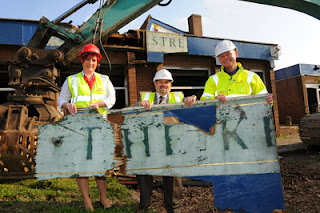
The councilor and property developers seem a bit too happy to be demolishing the Kestrel here.

Kestrel, Hugo Street. (c) Easier Property.

In this oddly disturbing shot they are reminiscent of big game hunters displaying the carcass of slaughtered prey.

Kestrel, Hugo Street. (c) Easier Property.

As of September 2012 the site of the old Kestrel was still vacant but I think new-builds have gone up since.

Former Kestrel, Hugo Street. (c) Google 2013. View Larger Map.

Dog & Partridge, Harrison Street

Dog & Partridge, Harrison Street, Hanky Park, Salford. (c) Neil Richardson [1].

Across the road from the Oddfellows Arms on Harrison Street stood the Dog & Partridge on the corner of Bury Street.  First recorded in 1861, the Dog & Partridge was an Empress Brewery beerhouse by the 1890s and it passed to Walkers of Warrington when they bought up all Empress's pubs and beerhouses in the 1920s.  By 1960s the Dog & Partridge was owned by Tetley's when it was included in the Ellor Street clearance scheme.  It closed in 1962 and the landlord moved to the Church on Mulberry Road [1].  The former location of the Dog & Partidge is where the Paddington Close entrance of the Salford Opportunities Centre is these days.

Former location of Dog & Partidge, Paddington Close. (c) Google 2013. View Larger Map.

1. Salford Pubs Part Three: Including Cross Lane, Broad Street, Hanky Park, the Height, Brindleheath, Charlestown and Weaste, Neil Richardson (2003).

Oddfellows Arms, Harrison Street

Oddfellows Arms, Harrison Street, Hanky Park, Salford. (c) Neil Richardson & Tony Flynn [1].

Running south of Ellor Street, Harrison Street in Hanky Park boasted two beerhouses, the Dog & Partridge and the Oddfellows Arms.  The Oddfellows was first recorded in 1848 and by 1896 had been bought up by Groves & Whitnall.  Like many pubs in the area, it was under the threat of closure due to poor trade, and in 1908 the police tried to close it by reporting it was quieter than four nearby beerhouses.  However, the Oddfellows was allowed to stay open after the landlord showed he was selling 6-7 barrels of beer a week, and it lasted until the Ellor Street clearance scheme of 1965 [2].  The Oddfellows Arms used to stand roughly where this odd little shop is on Paddington Close today.

Former location of Oddfellows Arms, Paddington Close. (c) Google 2013. View Larger Map.

1. Salford's Pubs 1, Neil Richardson & Tony Flynn (1978).
2. Salford Pubs Part Three: Including Cross Lane, Broad Street, Hanky Park, the Height, Brindleheath, Charlestown and Weaste, Neil Richardson (2003).

Alexandra Inn, Chapel Street

Alexandra Inn, Chapel Street, Hanky Park, Salford. (c) Neil Richardson & Tony Flynn [1].

This lesser-known Chapel Street in Salford used to run south off Broad Street to meet Ellor Street in the lost Hanky Park district.  Halfway down on the west side was the Alexandra Inn which can be traced back to the 1830s.  In 1902 Hardy's Crown Brewery bought the beerhouse and completely rebuilt it "from cellar to roof" but just 11 years later it was closed.  At the 1913 brewster sessions it was decided that the Alexandra must close as it was only selling four and a half barrels of beer (cask and bottles) a week.  The Alexandra Inn used to stand roughly where Whitebeam Close meets Broadwalk today.

Alexandra Inn, Chapel Street, Hanky Park, Salford. (c) Neil Richardson [2].

1. Salford's Pubs 1, Neil Richardson & Tony Flynn (1978).
2. Salford Pubs Part Two: Including Islington, Ordsall Lane and Ordsall, Oldfield Road, Regent Road and Broughton, Neil Richardson (2003).

Raglan Hotel, Radnor Street

Raglan Hotel, Radnor Street, Hulme, 1966. (c) Olga Cave / Bob Potts [1].

The Raglan Hotel stood on Radnor Street, on the corner with Embden Street and Raglan Street in southern Hulme.  It opened in 1856 and was a fully-licensed public house, eventually under Threlfalls Brewery [2].  It lasted over a century, closing in 1965, still under Threlfalls [1].  The former location of the Raglan Hotel is difficult to work out, but was roughly where Rawkin Close is in modern Hulme; Radnor Street used to head south off Stretford Road, where today's Shearsby Close runs.  Like their namesake, the Lord Raglan, over on Regent Road, the Raglan Hotel and Raglan Street will have been named after Lord Raglan, a celebrated soldier.
1. The Old Pubs of Hulme and Chorlton-on-Medlock, Bob Potts (1997).
2. The Old Pubs of Hulme Manchester (1) 1770-1930, Bob Potts (1983).

Lord Raglan, Regent Road

Lord Raglan, Regent Road, Salford. (c) Neil Richardson & Tony Flynn [1].

The Lord Raglan was, for most of its existence, on the corner of Oldfield Road and Regent Road, but it can be traced back to an original beerhouse on the corner of Regent Road and Oxford Street from the early 1860s.  The newer Lord Raglan opened in about 1872 and it survived until 1933 when licensing magistrates ordered its closure.  They ruled that it was too small with unsuitable upstairs accommodation and no yard, and owners Walker & Homfrays and lessees Swales Brewery were  paid compensation [2].  The new Wellington (now closed) stands where the Lord Raglan used to.

Former location of Lord Raglan, Regent Road. (c) Google 2013. View Larger Map.

1. Salford's Pubs 1, Neil Richardson & Tony Flynn (1978).
2. Salford Pubs Part Two: Including Islington, Ordsall Lane and Ordsall, Oldfield Road, Regent Road and Broughton, Neil Richardson (2003).

Sunday 15 September 2013

Plough Inn / Plough & Cotton Trade / Exhibition Inn, Pott Street

Plough Inn, Pott Street, Ancoats. (c) Neil Richardson [1].

The Plough Inn stood at the top of Pott Street on the corner with New Islington in Ancoats, as seen here in 1967.  It closed in 1970 and Pott Street was where the Cardroom Estate and the canal wharf were built.  The Plough Inn can be traced back to 1820 and may have briefly been known as the Wool Pack.  Advertisements in the 1830s and '40s refer to the Plough & Cotton Trade (see above 1836 advert) and in the 1860s it was the Exhibition Inn [1].  

Former location of Plough Inn, Pott Street, from New Union Street. (c) Google 2013. View Larger Map.

1. The Old Pubs of Ancoats, Neil Richardson (1987).

Tuesday 10 September 2013

Number V Vaults, Hope Street

Number V Vaults, Hope Street, Salford. (c) Neil Richardson & Tony Flynn [1].

Named in the same odd fashion as its neighbour, the Number IV Tavern, on Hope Street, the Number V Vaults beerhouse opened in the 1860s on the end of a row of dreaded back-to-back houses between West William Street and West John Street [2].  Both these little streets were lost to the railway but West Charles Street was the next street to the west and this still runs between Hope Street and Liverpool Street.

The Number V Vaults was a Groves & Whitnall house in the late-1800s but by 1909 it was on the closure list after some of the older dwellings in the area had been demolished.  The brewery reported sales of 4-5 barrels a week and assured the licensing authorities that they would improve the beerhouse.  Slight alterations resulted, but this did not really improve trade and the Number IV Tavern closed in 1927 [2].

The map of the Liverpool Street and Hope Street above, from Neil Richardson & Tony Flynn's original Salford book [1], shows that Hope Street once boasted seven boozers (including the Prince of Wales (numbered 37) and Number IV (40)).  The Number IV Vaults is numbered 42.  Of these 24 pubs and beerhouses shown, only one remains - the Holt's house, the Union Tavern (35).

Former location of Number V Vaults, Hope Street. (c) Google 2013. View Larger Map.

1. Salford's Pubs 1, Neil Richardson & Tony Flynn (1978).
2. Salford Pubs Part Two: Including Islington, Ordsall Lane and Ordsall, Oldfield Road, Regent Road and Broughton, Neil Richardson (2003).

Number IV Tavern, Hope Street

Number IV Tavern, Hope Street, Salford. (c) Neil Richardson & Tony Flynn [1].

This public house was an eventual casualty of the Manchester to Bolton railway which opened in the 1840s.  The Number IV Tavern had been Hope Street's oldest pub, opening in 1805 and eventually having its own brewhouse like many of Salford's original pubs.  The Empress Brewery had the Number IV by the early 1900s but the pub had to be pulled down in 1915 when the railway sidings were extended [2].  The old Number IV Tavern stood approximately here where the tree is, and the Prince of Wales was further along on the other side of Hope Street on the corner with Oldfield Road.

Former location of Number IV Tavern, Hope Street. (c) Google 2013. View Larger Map.

1. Salford's Pubs 1, Neil Richardson & Tony Flynn (1978).
2. Salford Pubs Part Two: Including Islington, Ordsall Lane and Ordsall, Oldfield Road, Regent Road and Broughton, Neil Richardson (2003).

Sunday 8 September 2013

Royal Oak, Oldham Road

Former location of Royal Oak, Oldham Road, Newton Heath. (c) Google 2013. View Larger Map.

The Royal Oak in Newton Heath was a large Wilsons pub on Oldham Road on the corner of Fletcher Street, shown here in 1970.  Royal Oak Park behind was named after the pub, established in 1864 as a 16 acre athletics ground and pleasure garden.  The Manchester Guardian described it as "one of the most superior sporting arenas in England, if not the world."  It held 20,000 people and also offered public showers to the people of Newton Heath (price 1 penny) [1].  The Royal Oak closed in 1991 [2] and has been knocked down and replaced by a Holiday Inn. 

Royal Oak Park, Oldham Road. (c) Samantha-Jayne Oldfield & Dave Day [1].

1. Manchester's Sporting Past: Nineteenth Century Athletic Grounds, Samantha-Jayne Oldfield & Dave Day, Manchester Metropolitan University.
2. What's Doing, CAMRA, April 1991.

Caught on the Hop, Withington Road

Former location of Caught on the Hop, Withington Road, Whalley Range. (c) Google 2013. View Larger Map.

The Caught on the Hop stood on Withington Road near the junction with Yarburgh Street and Range Road in Whalley Range.  These days the new-build Range Medical Centre sits here and the pub was a similarly-bland looking 1970s estate-style boozer, though a picture has proved elusive.  The Caught on the Hop was closed in the early 1990s with problems related to drug dealing being one reason for its boarding up.  The Manchester CAMRA December 1991 issue of What's Doing mentions the Caught on the Hop closing (though as a Hulme pub), along with the Spinners, Crown, Bulls Head (pictured below; recently demolished), and further out, the Greyhound in Partington [1].  None of these pubs survived.

Caught on the Hop, Withington Road (Bulls Head, Chester Road). (c) What's Doing [1].

1. What's Doing, CAMRA (December 1991).

Saturday 7 September 2013

Park Inn, Mill Street

Park Inn, Mill Street, Bradford. (c) Manchester Local Image Collection. Click here to view full image [1].

The Park Inn is shown here on Mill Street, Bradford in 1903 in splendid isolation with the Bradford Colliery in the distance in the industrial smog.  By 1963 the Chesters house had a new neighbour and this photo taken through the entrance of Phillips Park explains the name of the pub.  By 1971 the Park Inn had passed to the hapless Whitbread and the pub lasted another two decades before being lost to the creation of the Alan Turing Way "East Manchester Intermediate Ring Road" in 1992 [2].

Park Inn (1), Mill Street. (c) What's Doing [2].

As well as the Park Inn (1, above), the Alexandra (2) and Navigation (3) were also lost during the changes as this part of Bradford was redeveloped into Eastlands.  Pete Ellis describes the Park Inn as a place of startling characters, a space to observe and listen in, drinking cold lager in small, crowded, animated rooms.  As Zulu came on the TV,  Terry the binman shouted: "Here we go lads, Beswick versus Moss Side [3]."  Opposite the Phillips Park gates these days is nothing but an advertising hoarding with the stadium car park behind.

Phillips Park, Bradford. (c) View Larger Map.

Former location of Park Inn, Mill Street. (c) Google 2013. View Larger Map.

2. What's Doing, CAMRA (January 1991).

Thursday 5 September 2013

Midland Arms, Temperance Street

Midland Arms, Temperance Street, Ardwick. (c) Hulme, C.on-M, All Saints, Ardwick FaceBook.

The Midland Arms stood opposite the Imperial Inn on the ironically-named Temperance Street in Ardwick.  Most likely named after the railway which dominates the street scene, two small children can be seen playing outside the Midland in this photo.

Midland Arms, Temperance Street, Ardwick. (c)Hulme, C.on-M, All Saints, Ardwick FaceBook.

By taking the exact position on Temperance street many decades after the above photo was taken, the sad state of this corner of Ardwick can be seen.  Industrial yards and derelict land have taken the place of the old Imperial Inn and the Midland Arms.

Former location of Midland Arms, Temperance Street. (c) Google 2013. View Larger Map.

Navigation Inn, Mill Street

Navigation Inn, Mill Street, Bradford. (c) D.N. at ManMates Facebook [1].

The Navigation Inn stood on the lost Mill Street in Bradford, opposite the entrance to Phillips Park, pictured above as a Greenall Whitley house in July 1984 thanks to the ManMates Facebook [1].  Of course these days Alan Turing Way runs past here and Manchester City's stadium stands behind where the pub used to stand, rather than Bradford Colliery.  The tram now runs beneath the road here, having passed the City of Manchester Stadium before it snakes along past ASDA and up Ashton New Road.

Former location of Navigation Inn, Mill Street, Bradford. (c) Pete Ellis at Leeds Met [2].

There are memories of the old Navigation from Pete Ellis whose dad used the pub as his local: "I played pool with him or stood in the tiny lobby sucking on cool pints, chewing the fay, being introduced to boozing chums and characters and oddballs in a Joycean narrative of juxtaposed, amiably bizarre conversations. [2]"  The Navigation is shown at the archives as Red Rose Ales (Groves & Whitnall) in 1963 and 1971.

Former location of Navigation Inn, Alan Turing Way (former Mill Street). (c) Google 2013. View Larger Map.

Tuesday 3 September 2013

Queens Arms, Florin Street

Queens Arms, Florin Street, Hanky Park, Salford. (c) Tony Flynn [1].

The Queens Arms beerhouse opened on Tanners Lane, Hanky Park in 1837, boasting pleasure gardens in the 1850s.  These gardens were soon built over with the back-to-back terraces of Meldrum Street and Melrose Street.  Later that century the Queens became a Swales house but in 1875 a spirits licence was refused despite £2,000 having been spent on renovations to the beerhouse.  By this time the street layout of Hanky Park had changes and the address of the Queens was now Florin Street, and here it stood until the 1963 compulsory purchase order saw it off.  The Queens Arms, nicknamed "The Stumps" eventually closed in 1965 [2] and was lost along with the rest of Hanky Park.  The approximate location of the old Queens Arms would have been just south of where the remains of the western end of Ellor Street is marked on today's map.

1. Hanky Park, Tony Flynn (1990).
2. Salford Pubs Part Three: Including Cross Lane, Broad Street, Hanky Park, the Height, Brindleheath, Charlestown and Weaste, Neil Richardson (2003).

Two Hundred, Carisbrook Street

Two Hundred, Carisbrook Street, Harpurhey. (c) Google 2013. View Larger Map.

The Two Hundred, or Boddingtons 200 as it was first known on opening in the late 1970s, was unsurprisingly, a Boddies pub.  A rather grim-looking estate boozer, it was so-named as it was Boddingtons' 200th pub, and the council estate here just off Rochdale Road is still known as the "200 Estate".

Two Hundred, Carisbrook Street. (c) Google 2013. View Larger Map.

The Two Hundred has been closed for a number of years and for while appeared to be owned by the notorious Des Noonan after it had closed as boozer.  Despite the state of its rear in 2012, new windows were being put in during August 2013 so perhaps a new lease of life awaits for what was once "one of Boddingtons better new pubs [1].

Two Hundred, Carisbrook Street. (c) Google 2013. View Larger Map.

1. Greater Manchester Good Beer Guide, CAMRA (year unknown).

Heywood Arms, Oldham Road

Heywood Arms, Oldham Road, Miles Platting. (c) Manchester Local Image Collection. Click here to view full image.

The Heywood Arms was a Wilsons house on the main Oldham Road running through Miles Platting, as the advert on the side suggests - "I like Olympic Superb Pale Ale", That's Why He's A Wilsonian.  It used to stand on the corner of Fir Street in the shadow of St John the Evangelist church (seen here in 1961) which itself straddled Fir Street and Shetland Road.  In 1972 the church was deconsecrated and pulled down and the new-build church, St Cuthbert's, was founded in its place [1].  The Heywood Arms is shown here in 1970, probably just a couple of years before its closure and demolition.  New houses have recently gone up on the spot where the Heywood Arms once stood.

Former location of Heywood Arms, Oldham Road. (c) Google 2013. View Larger Map.