
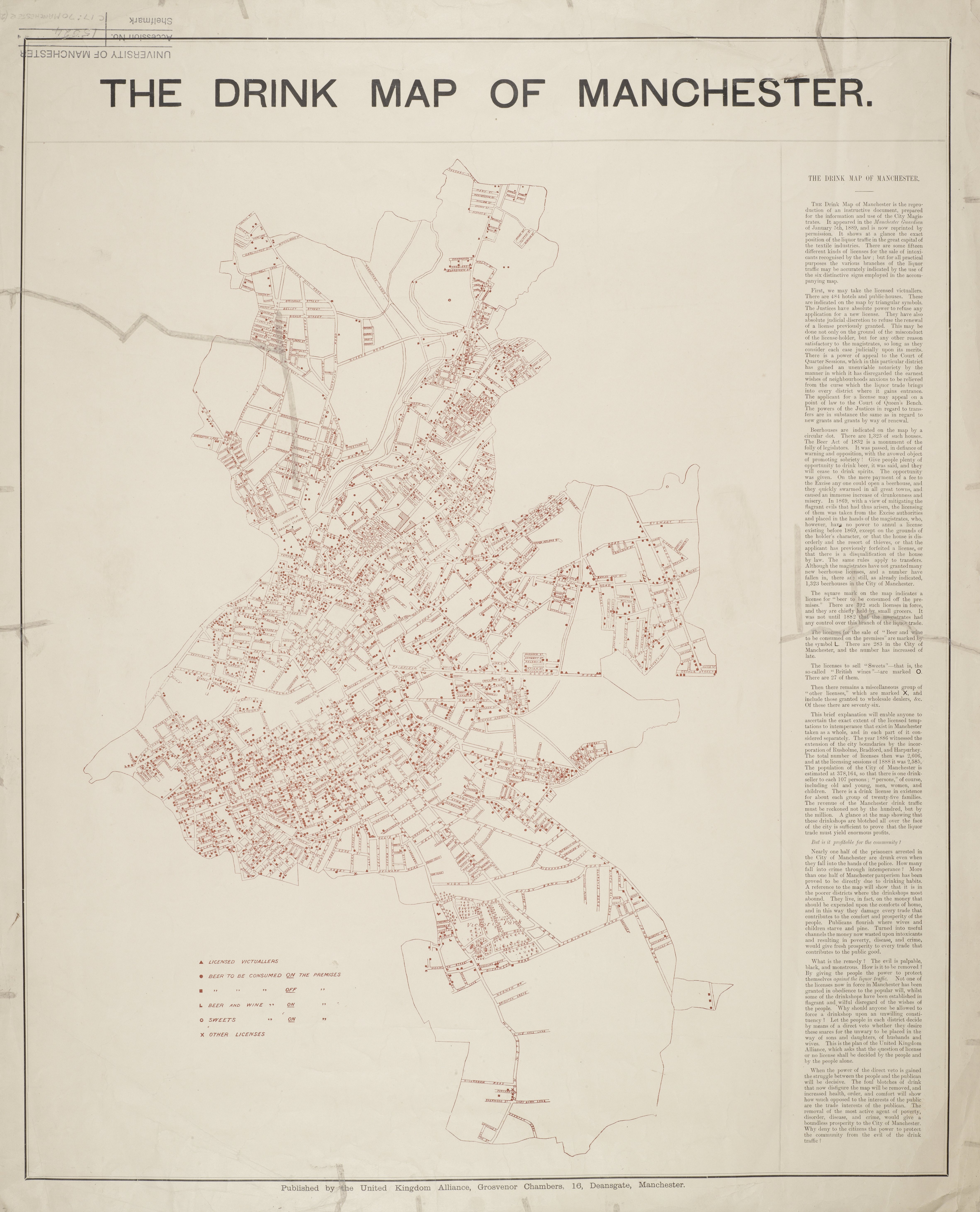
This is a fantastic map of the city's licensed premises from 1889 (note the area covered is slightly larger than ours, incorporating Hurpurhey, Bradford and Rusholme).
- 484 hotels and public houses (triangles)
- 1,323 beerhouses (dots)
- 283 licenses for "beer and wine to be consumed on the premises" ('L')
- 27 "licenses to sell sweets" (British wines) ('O').
- the off-licences (392; squares) and wholesalers (76; 'X') we'll not count
= 2,117 licensed premises
Note the other stats listed on the map - 1 booze outlet for every 107 persons, or 1 for every 25 families. It then goes on a temperance rant, "foul blotches of drink... why deny to the citizens the power to protect the community from the evil of the drink traffic." This map was originally printed in the Manchester Guardian - I'm sure they wouldn't approve of such puritanism.
Thanks to Mez at skyscrapercity for this find.

Hi, is there any way to buy a print version of this image? Thanks
ReplyDelete