Pubs of Manchester

All pubs within the city centre and beyond.
A history of Manchester's hundreds of lost pubs.

Wednesday, 30 March 2011

Eagle & Child Tavern, Exchange Street

On what is now the Exchange Street part of St Anne's Square, the Eagle & Child Tavern stood, around 360 years ago.  It was 1642 when the onset of the Civil War in Manchester led to the Royalist faction of Manchester inviting Lord Strange, the son of the Earl of Derby and prominent land owner, to Manchester.  The Royalists dined at the Eagle & Child Tavern, whereupon they were attacked by militant artisans and parliamentarians.  Strange narrowly avoided being shot and many of the Royalists were injured.  The one man was killed outside the pub was the first official casualty of the Civil War [1].


A History of Manchester. (c) amazon.

1. A History of Manchester, Stuart Hylton (2003).

Tuesday, 29 March 2011

147. Alibi / Varsity / Barracuda / Springbok - Oxford Street

Alibi, Oxford Street. (c) partyatthepub.

A bar that has been many guises over the years, all to varying levels of success.  It would appear that it becomes the current bar of choice for about six months before lapsing back into a nearly-bar again, picking up the occasional lost stag or hen party, possibly coming in off the train at Oxford Road station.  At times, especially at Christmas it's busy, but its location doesn't really bode well for it to ever be part of the In-Crowd's tour of bars and pubs and as such presumably this is why it trys reinventing itself every couple of years.  Sat next to Paramount Wetherspoons at the top of Oxford Street near the site of the old Banshee, it will never compete on price, but maybe it's more attractive to the female of the species if that's the way you are walking into town.


Alibi, Oxford Street. (c) partyatthepub.

The bar itself has changed little in its many different names, although as Alibi they have now disposed of the booths and it is far lighter and more welcoming than it was.  I recall being turned away from Varsity once because we were too wet... having just been caught in a torrential downpour.  Also remember turning away in disgust at the beer on offer - draught lager and cider only.  However, much to our amazement, Alibi has now started selling real ales, which was a pleasant surprise and shows that even the ponciest (and previously, poorest) of bars are now stocking it as clearly something the public wants.  Though served far too cold (beggars can't be choosers), maybe just maybe, a corner has been turned here and we will continue to see this progression to real ale in more and more bars in the city centre now.

Monday, 28 March 2011

Three Crowns, Crown Street


Former location of Three Crowns, Crown Street (to the right). (c) googlemaps.

At the bottom of Angel Meadow on what was, until recently, the top end of Dantzic Street used to be Blakeley Street, and cutting across the top end was Crown Street, which used to meet up with the bottom of Crown Lane.  The Three Crowns stood on the right half way along as shown on the modern day map below [1].  It would have stood just around the corner from the famous old Crown & Cushion, Manchester's oldest licensed premises, soon to be swallowed up by the Co-Op HQ development, like the factory shown on the recent googlemaps images that used to stand on the site of the old Three Crowns.

former location of Three Crowns, Crown Street. (c) googlemaps.

1. Manchester (New Cross) 1849, Alan Godfrey Maps (2009).

Thursday, 24 March 2011

George Inn, Deansgate


Former location of George Inn, Deansgate (left). (c) googlemaps.

Just a few doors up Deansgate and opposite the Sawyers Arms (far right in above shot) is the location of the old George Inn (left).  It would have stood next to the Kings Arms, separated by Back King Street (now South King Street).  Then at No.103 Deansgate, Sarah and John Richardson had the George Inn in the mid 1850s [1].  Now at this spot - the numbering hasn't changed too much - is the Spanish restaurant La Vina at No.105-107.

Former George Inn, now La Vina, Deansgate. (c) mrrobertwade at flickr.

1. Manchester City Centre 1849, Alan Godfrey Maps (2008).

Kings Arms Tap, Back King Street

Former location of Kings Arms Tap, Back (South) King Street. (c) googlemaps.

The Kings Arms Tap was a tiny beerhouse, separate and to the rear of the main Kings Arms Hotel that stood on Deansgate.  It was tucked away down Back King Street (now South King Street) and sat just opposite what is now the entrance to South nightclub (formerly the Stuffed Olive / Bernard's Bar), one door along from the Jaeger shop on the corner of South King Street and Ridgefield [1].

1. Manchester City Centre 1849, Alan Godfrey Maps (2008).

Wednesday, 23 March 2011

146. Gaslamp, Bridge Street

Gaslamp, Bridge Street. (c) citylife.

Blink and you'll miss this place, literally.  Indeed it took us a little searching and a re-check of the address to find it but it was worth it when we did.  It's actually about four doors down from the Bridge, although it is underneath the current block, reached by a set of stairs, which appear to disappear into the very bowels of the city.  A small sign outside and a brass gaslamp are the only giveaways to its location.  Once downstairs, it's two rooms with a large main bar area and a further smaller more intimate room at the back.  This also doubles as the function room should you require to book it, though you wouldn't want it to be a huge party as it would be a bit crowded.  The main room, is bigger with plenty of seating and a large bar at one end.  The whole premises reminds me a little an old air raid shelter and the polished period tiles add to this effect.  But don't let this put you off, as the Gaslamp carries it off superbly.

Gaslamp, Bridge Street. (c) citylife.

As far as beer is concerned, only one real ale was available during our visit, which was a Brewdog's superb 5AM Saint (red and hoppy) which was well kept and served unusually in a dimpled pint pot which was a nice touch.  There is also a large selection of bottled lagers and a couple of draught foreign lagers also, and according to the Gaslamp website they've had plenty of real ales on since.  So to conclude, a fine little bar which I hope succeeds.  If there was one particular problem, is that it perhaps wants to be a Northern Quarter bar without actually being there.  Whether this will hold it back in the future, only time will tell, but it deserves a good crack at it.  Hopefully its success will breed a new area of bars in this area of town which is sadly lacking in decent places to drink.

Website:  http://the-gaslamp.tumblr.com.

Tuesday, 22 March 2011

Punch Bowl, Chapel Street

Punch Bowl, Chapel Street, 1990. (c) deltrems at flickr.

This building on the corner of Chapel Street and Booth Street, just a few doors down from the still open Rovers Return, was the Punch Bowl.  It's a Grade II listed building and the listing incorporates another old pub to the rear, the Wagon & Horses, both which apparently date back to 1817 [1].  To the rear of the Punch Bowl was the separate Peggy's Bar in the 1970s [2], which one presumes is the old Wagon & Horses premises.  

Former Punch Bowl, Chapel Street. (c) Google 2011. View Larger Map.

In the mid-1970s the Punch Bowl was a highly recommended pub, offering decent Tetley's on electric pump, Guinness, Double Diamond and Skol.  The interior decor included military artefacts, French seaside postcards, cigarette cards and flags.  There was also a painting of Salford in which every building was a pub, plus a "Tetley's Lord's Prayer" written by an old regular [2].


Former Punch Bowl, Chapel Street. (c) Salford.gov.uk.

Our brewer which art in heaven,
Tetley be thy name;
Thy bitter come, it will be drunk, 
In Earth as it is in heaven.
Give us this day our daily beer,
And forgive us our abstinence,
As we forgive those that endorse prohibition;
And lead us not to Wilsons, and deliver us from Chesters,
For thine is the bitter, the mild, pale and lager,
Forever and ever... Hic.


Punch Bowl, Chapel Street, 1975. (c) Manchester Pub Surveys [2].

1. www.britishlistedbuildings.co.uk/en-471538-4-salford.
2. The Manchester Pub Guide, Manchester and Salford City Centres, Manchester Pub Surveys (1975).

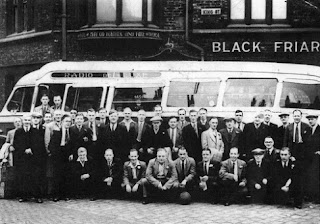
Black Friar, Blackfriars Road / King Street

Black Friar, Blackfriars Road. (c) deltrems at flickr..

On the corner of Blackfriars Road and the Salford side of the inner ring road, Trinity Way, sits the firmly closed Boddies house, the Black Friar, also known as the Blackfriars Hotel for a time [1].  As the stone engraving states, the building dates from 1886 but originally the pub at this site was the Old School Inn [2].  The 1848 Ordnance Survey map shows that old School Inn on the corner on King Street, on the corner with Blossom Street [3], also seen below in 1949.

Black Friar, King Street. (c) robsue888 at flickr.

When Blackfriars Road was extended from Manchester right into Salford the road layouts around here began to change beyond all recognition, so when the current pub was built in 1886, it was now on the corner of Blackfriars, King Street and Blossom Street.  You can just make out the old Blossom Street sign on the side of the pub.  

Black Friar, Blackfriars Road. (c) a_marga at flickr.

In 1975 the Blackfriars Hotel was described as an attractive smoke-blackened building with "You may go further and fare worse" engraved on the front wall.  It had a bees and corn sheath coat of arms with the inscription "Black Friars Old School" - a nod to the old pub, or perhaps reference to an even older function of the building that once stood here?  The Boddington's bitter was so good in the Blackfriars Hotel that keg ale and lager was not even available [1].  

Black Friar, Blackfriars Road, 1989. (c) CAMRA [2].

By 1989, Trinity Way had been built and the pub had reverted back to the Black Friar, a Boddington's house, yet it remained a thriving community local despite the changes going on around it [2].  The pub remains a Grade II listed building with the exterior and interior listed in detail here [4], having closed not that many years ago.

Black Friar, Blackfriars Road. (c) googlemaps.

1. The Manchester Pub Guide, Manchester & Salford City Centres (1975).
2. Ales of Two Cities, Real Ale & Real Ale Pubs in Manchester and Salford, CAMRA (1989).
3. Salford Pubs - Part One: The Old Town, icluding Chapel Street, Greengate and the Adelphi, Neil Richardson (2003).
4. www.britishlistedbuildings.co.uk/en-471505-black-friar-public-house-salford.

Monday, 21 March 2011

Bull's Head, Chester Road

Bull's Head, Chester Road. (c) googlemaps.

This old Handley's Brewery and Threlfalls house closed in 1993, and like the Turville (far right, above), Cornbrook Inn, Railway and many, many more around the city centre end of Chester Road, appears lost forever.  Thankfully at least the sign of the Bull's Head Hotel is a reminder of the former function of this Tel Signs business premises.

Bull's Head, Chester Road. (c) kevinfromHulme at exhulme.


Bull's Head, Chester Road. (c) googlemaps.

The Bulls Head was famous locally for a time as Frank Yonco's pub in the 1960s when the likes of Karl Denver would pop in for a drink [1].  A few doors along Chester Road towards Old Trafford is the still standing and until very recently, sometimes open Hydes pub, the Hope Inn (as of April 2011 occupied by squatters [2]), outside which the below shot is taken.  

Bull's Head, Chester Road. (c) googlemaps.

Saturday, 19 March 2011

Stage 1, Albion Street

Possibly former location of Stage 1, Albion Street. (c) dubwise-er at MDMA.

There's every possibility that Stage 1, an Albion Street club listed in 1983 [1], was in the old (and now vacant) Aqua Bar premises.  But until we confirm either way it'll have its own entry.

1. www.mdmarchive.co.uk/archive/showartefact.php?aid=7808.

Reflections, Peter Street

Reflections, Peter Street. (c) dubwise-er at MDMA.

There is a spa in the Midland Hotel called Reflections, however this may just be a coincidence, as this Reflections is in a 1983 club listing [1].  No idea whereabouts on Peter Street this was though.

1. www.mdmarchive.co.uk/archive/showartefact.php?aid=7808.

Millionaires Club, Bridge Street

Millionaires Club, Bridge Street. (c) dubwise-er at MDMA.

Not to be confused with the Millionaire Club on Marble Street run by the Stringfellows, this club was somewhere on Bridge Street in the 1980s as seen in a 1983 club listing [1].

1. www.mdmarchive.co.uk/archive/showartefact.php?aid=7808.

Annabels, Wood Street

Possible former location of Annabels, Wood Street. (c) googlemaps.

It's possible that this old nightclub was once the Beer Keller on Wood Street, just off Deansgate, down the side of the Hog's Head.  Annabels was at No.8 Wood Street in the early 1980s [1] and as the only legible number on the whole street is No.26 at the far end on the right, it's possible that Annabels was on in or under this building.  Anyone remember this one?

1. www.mdmarchive.co.uk/archive/showartefact.php?aid=7808.

Number 1 Club, Central Street

One Central Street, Central Street. (c) ASBO Allstar at flickr.

Until recently this place was best known as One Central Street, but has recently reverted back to the Number 1 Club title as a gay club.  This old basement venue was a discotheque in the 1980s, then a gay-only club in the late '80s and '90s.  It sits beneath a Grade II listed building behind the Town Hall, and despite its central location, is a bit of an unknown venue and perhaps might have wider appeal as a normal bar in this pub-free part of town.

One Central Street, Central Street. (c) whln.co.uk.

The original Number 1 Club was run by Geoff Stringfellow [1], brother the legendary Peter.  Both Stringfellows had previously been involved at the Millionaire Club.

Number 1 Club, Central Street, 1983. (c) dubwise-er at MDMA.

1. www.mdmarchive.co.uk/archive/showartefact.php?aid=7818.

Friday, 18 March 2011

Duke of York, Copperas Street

Former location of Duke of York, Copperas Street. (c) googlemaps.

Parallel to Edge Street and running between High Street and Oak Street in the Northern Quarter is Copperas Street.  On this corner of what is now Hare Street, formerly Harrop Street, used to stand the Duke of York in the mid-1800s [1].  Looking down Copperas Street to the preserved Fish Market facade on High Street, the white coloured flats sit on the site of the old Duke of York.

1. Manchester (New Cross) 1849, Alan Godfrey Maps (2009).

Old Boars Head, Lower King Street

Former location of Old Boars Head, Lower King Street (King Street West). (c) googlemaps.

Next door to Mario Balotelli's second home, San Carlo (the old Maxwells / King's), on King Street West (formerly Lower King Street), is King's House, home to the Berrymans Lace Mawer legal firm.  In the mid-1800s, before this was built, sat the Old Bears Head.  Pork Lane was to the rear and separating the Weights and Measures Office (where San Carlo is)  from the Old Boars Head was the tiny Court Lane [1].

1. Manchester City Centre 1849, Alan Godfrey Maps (2008).

Wednesday, 16 March 2011

Red Lion / Raven Hotel, Chapel Street

Raven Hotel (left), Chapel Street, 1930s. (c) Neil Richardson [1].

On the site of the old bus station, and before that, the Exchange Station approach, the Red Lion sat at the bottom of Chapel Street on left as you looked up the road.  The Red Lion's licence was first recorded in 1742 and by 1840 had "a bar, parlours, dining room, a large club room, twenty beds, stabling for forty horses and two lock-up coach houses [1]."  With entrances on Victoria Bridge and Chapel Street, it was big hotel, renamed the Raven Hotel in the late 1860s when it was rebuilt, as shown above.

Former location of Red Lion / Raven Hotel, Chapel Street. (c) Adam B. at flickr.

By the 1930s, Boddingtons Brewery leased the hotel of owners, the London, Midland & Scottish Railway and when Salford Corporation acquired all the land between Cathedral Approach and Victoria Bridge Street for the building of the bus station, the Raven Hotel's licence was sold to Threllfalls Brewery.  They immediately transferred it to a beerhouse of theirs and the Raven was demolished [1].  The old site of the Red Lion / Raven Hotel is roughly where the car park sign is, below, looking from the bottom of Green Gate [2].


Former location of Red Lion / Raven Hotel, Chapel Street. (c) googlemaps.

1. Salford Pubs - Part One: The Old Town, including Chapel Street, Greengate and the Adelphi, Neil Richardson (2003).
2. Manchester Victoria 1849, Alan Godfrey Maps (2009).

Tuesday, 15 March 2011

Old Golden Lion, Deansgate

Former location of Old Golden Lion, Deansgate. (c) googlemaps.

This building clad in scaffolding and sheeting straddles Quay Street and Atkinson Street on Deansgate.  In the mid-1800s the Old Golden Lion sat two doors up from the Royal Oak and next door but one to Cupid's Alley, which was a more romantic name for the modern day Atkinson Street [1].  Beneath the scaffolding are several businesses; the  Old Golden Lion sat just about where the Mobden Sharps is today next to the Tantune Deli & Coffee House.  


Former location of Old Golden Lion, Deansgate. (c) www.192.com / Local Data Company.

1. Manchester City Centre 1849, Alan Godfrey Maps (2008).

Royal Oak, Deansgate

Former location of Royal Oak, Deansgate. (c) googlemaps.

Just across Bradshaw Gate (a long-lost little alleyway off Deansgate opposite Bootle Street that almost met up with Little Quay Street) from the Unicorn was the Royal Oak in the mid-1800s [1].  The map above shows the former location of Bradshaw Gate and the position of the Royal Oak on its north corner of Deansgate.

1. Manchester City Centre 1849, Alan Godfrey Maps (2008).

Grecian's Head, Deansgate

Former location of Grecian's Head, Deansgate. (c) googlemaps.

Today just one building separates Peter Street from Bootle Street, but in the mid-1800s there were four Deansgate premises here.  The second one up from Peter Street was the Grecian's Head run by Samuel Jones and opposite was the Unicorn [1].  These days the Ellis Brigham mountain sports equipment shop sits on the site of the old Grecian's Head.

1. Manchester City Centre 1849, Alan Godfrey Maps (2008).

Swan Inn, Deansgate

Former location of Swan Inn, Deansgate. (c) googlemaps.

Lad Lane was a road off Deansgate, just three premises south of Peter Street, and on the north corner was the Swan Inn [1].  This puts former location where the old and, preserved London & North East Railway Goods Depot archway is today, indicating its fate.  In the mid-1880s the Swan was kept by Robert Rowland and stood directly opposite the Grapes which lasted at least a century longer [1].

Former location of Swan Inn, Deansgate. (c) googlemaps.

1. Manchester City Centre 1849, Alan Godfrey Maps (2008).

Wednesday, 9 March 2011

Kings Arms, Helmshore Walk / Robert Street

Kings Arms, Helmshore Walk, Chorlton-on-Medlock, 1991. (c) deltrems at flickr.

The Kings Arms sits on Helmshore Walk on the delightfully named Skerry Close, well hidden between Upper Brook Street and Ardwick Green, just off the Mancunian Way.  The pub survived slum clearance, as it was originally on Robert Street before the razing this part of Chorlton-on-Medlock and the building of grim flats and council houses.  Although these days something of a forgotten old pub, the place holds a significance for modern day Manchester ale aficionados, as it was at the Kings Arms where Brendon Dobbin started the West Coast Brewery microbrewery in 1989, famed at the time for its stout and strong, hoppy Yakima Grande pale ale.  Dobbin went on to set up the Marble Arch as a brew pub and he also helped design and install the brewery plant [1] - so is partly to thank for the revitalisation of the "Manchester Pale Ale" styles we're enjoying today then.  The pub closed some years ago, and as a trading brew pub was apparently blighted by the scallies from the local estates.  The story wasn't much different in the 1950s when Bill Carroll took over and "...bad characters had driven away most of the customers, so a firm hand was needed to get the pub back to a profitable footing" [2].  

Kings Arms, Helmshore Walk, Chorlton-on-Medlock. (c) googlemaps.

1. www.steelcitybrewing.co.uk/gen_midatlantic.htm
2. The Old Pubs of Hulme & Chorlton-on-Medlock, Bob Potts (1997).

Old Shears, Greengate

Old Shears, Greengate, Salford. (c) deltrems at flickr.

Described as a dinner time, factory workers type boozer in the 1970s, the Old Shears offered hand-pulled Wilsons plus Carlsberg and Watneys Red for the less discerning drinker [1].  The Old Shears on Greengate, just over the River Irwell into the neighbouring city, can be traced back to about 1760.  The pub was also named the Rising Sun (1805-1809) and the Iron Bridge Tavern (1824).  Wilsons Brewery took the Old Shears in the 1940s and it thrived until the late 1970s when the nearby bus stations at Chapel Street and under the Greengate arches closed, and the new Trinity Way ring road cut Greengate in half.  The pub shut for good in 1987 and was derelict and roofless until its demolition in 1993 [2].  Its location was on Greengate just at the end of New Bridge Street where the car park is now.  Back in the mid 1800s it would have faced the old Green Gate fruit & veg market here at Salford Cross / Market Cross [3].

Former location of Old Shears, Greengate, Salford. (c) googlemaps.

Stu Forster remembers "...whilst frequenting Manchester in the early-mid-'80s this pub became an institution.  When the Hacienda closed its doors at 2am, we would knock landlord Barry Johnson up out of bed and sup beer, play pool and pump the jukebox till daylight.  We would often return on Sunday afternoons when other boozers locked their doors at 2pm, again supping beer till the pubs in town opened again at 7pm.  I remember jumping in a cab at about 9am one Saturday morning and saying 'take me to the Old Shears in Greengate'.  The cabbie replied 'do you like antique beer?'.  Great days [4]".

1. The Manchester Pub Guide, Manchester & Salford Pub City Centres (1975). 
2. Salford Pubs - Part One: The Old Town, including Chapel Street, Greenate and the Adelphi, Neil Richardson (2003).
3. Manchester Victoria 1849, Alan Godfrey Maps (2009).
4. www.flickr.com/photos/deltrems/2671236402/.

Trevelyan Hotel, Corporation Street

The Trevelyan Hotel only exists in the form of this line drawing from the archives.  This depiction of the hotel on Corporation Street is described as "from Memus, vol 7, page 29" in the 1880s [1].  Looks like the Trevelyan goes back further than the 1915 and 1849 maps on which it's not listed...

1. http://images.manchester.gov.uk/.

Tuesday, 8 March 2011

Prince of Wales, Oldfield Road

Prince of Wales, Oldfield Road, 1992. (c) deltrems at flickr.

Down Oldfield Road from the St Phillips Hotel (later Jollies), was the Prince of Wales at No.165.  It was pulled down at some point in the 1990s despite being a still popular pub in the preceding decades, and has been replaced with "The Fusion" apartments on the corner of Middlewood Street (note how the brick wall - the start of the railway bridge - is still the same).  In the 1970s it was described as a "good Northern end-of-the-street-pub" with Tetley bitter and mild on beer engines and Skol and Guinness on keg [1].

Former location of Prince of Wales, Oldfield Road, Salford. (c) googlemaps.

The Prince of Wales was originally a shop when Samuel Lord opened it as the fully licensed Railway and Drovers Inn.  By 1845 the pub had assumed the Prince of Wales name although in the directory it was listed as the Prince of Wales and Yorkshire House in the 1860s-'70s.  The pub was rebuilt in the early 20th century by Cornbrook Brewery and included a shop next door which was a hairdressers then funeral parlour.  By 1949 the Prince of Wales was included in th Hampson Street compulsory purchase area but it was spared following a change of plans and Bass Charrington had it in the 1960s when they incorporated the shop into the pub.  A final stint as a freehouse from 1985 saw it last until closure and demolition in 2001 [2].  

1. The Manchester Pub Guide, Manchester & Salford City Centres (1975)
2. Salford Pubs - Part Two: Including Islington, Ordsall Lane and Ordsall, Oldfield Road, Regent Road and Broughton, Neil Richardson (2003).

Jollies / St Phillips Hotel, Oldfield Road

Jollies, Oldfield Road, Salford, 1989. (c) deltrems at flickr.

This old pub was still standing derelict when we did our Salford pub crawl last year, but it's since been demolished.  Originally the St Phillips Hotel, Jollies is yet another to add to the Chapel Street - Crescent pubs death knoll (despite being just off The Crescent on Oldfield Road on the corner of Factory Lane).   

St Phillips Hotel, Oldfield Road, Salford. (c) Salford_66 at flickr.

In the above photo from Salford 1940-1965 by Roy Bullock there is a "....e of Wales", apparently next door, which is probably the the Prince of Wales, which is odd, as there was recently a Prince of Wales further down Oldfield Road.  

Jollies / St Phillips Hotel, Oldfield Road, Salford, 2008. (c) Adam B at flickr.