Pubs of Manchester

All pubs within the city centre and beyond.
A history of Manchester's hundreds of lost pubs.

Thursday, 28 November 2013

Priory Hotel, High Street

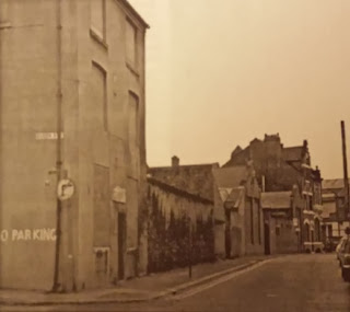
Priory, High Street, Hanky Park, Salford. (c) Neil Richardson [1].

Most of Hanky Park was wiped off the map in the mid-1960s, but there are some remnants, such as West Hight Street, which used to be simple the High Street, where the Priory Hotel once stood.  It was named after an old beerhouse that was lost when Pendleton New Station was built.  

The Priory Hotel was built on the corner of Ruthin Street and High Street in 1886 by Threlfalls, and for decades fought to get a full licence, a request which was repeatedly rejected until it was finally granted in 1937.  This only occurred when the Raven Hotel's licence on Chapel Street was transferred, as it was getting pulled for Victoria Bus Station.

In 1915, the Priory had its windows smashed during the Lusitania Riots as the landlord had a German-sounding name - he went to the trouble of putting up posters offering a tenner to anyone who could prove he wasn't English!  The Priory came to a familiar end - it was closed and demolished in 1965 under a compulsory purchase order [1].

1. Salford Pubs Part Three: Including Cross Lane, Broad Street, Hanky Park, the Height, Brindleheath, Charlestown and Weaste, Neil Richardson (2003).

Druids Rest, Pimlot Street

Druids Rest, Pimlot Street, Hanky Park, Salford. (c) Neil Richardson [1].

The Druids Rest stood on the corner of Peel Street and Pimlot Street in Hanky Park, and can be traced back to 1858.  When the landlord was fined for selling the "long pull" in 1907, the Druids Rest was a Threlfalls house, and Alfred Rimmer told magistrates that neighbouring boozers were doing it, so what could he do?  In 1913 Threlfalls rebuilt the frontage of the beerhouse and the Druids Rest lasted until 'Black Sunday', that fateful day, 28th April 1963, when most of Hanky Park's pubs and beerhouses were killed off [1].  Pimlot Street used to run from Broad Street (opposite Frederick Street) to Ellor Street, so the Druids Rest was just south of where Belvedere Road is marked.

1. Salford Pubs Part Three: Including Cross Lane, Broad Street, Hanky Park, the Height, Brindleheath, Charlestown and Weaste, Neil Richardson (2003).

Saturday, 23 November 2013

Welcome Inn, Lloyd Street

Welcome Inn, Lloyd Street, Hulme. (c) Bob Potts [1].

The Welcome Inn was originally known as the Flintshire House, as reported in the 1861 census.  Then-landlady, Elizabeth Williams and her husband were from Wales which explains the the Flintshire connection.  The Welcome Inn stood at No.20 Lloyd Street on the corner with Queen Street (now Quenby Street), and was a Hardy's then Peter Walker & Son house, closing in 1935 [1,2].  Lloyd Street was renamed Linby Street and still runs through Hulme, though no longer meets up with Chester Road.  One of the refurbished blocks of flats marks the spot where the Welcome once stood.

Former location of Welcome Inn, Linby Street (formerly Lloyd Street). (c) Google 2013. View Larger Map.

1. The Old Pubs of Hulme Manchester (1) 1770-1930, Bob Potts (1983).
2. The Old Pubs of Hulme and Chorlton-on-Medlock, Bob Potts (1997).

Church Inn, Chester Street

Church Inn, Chester Street, Hulme. (c) Bob Potts [1].

The Church Inn was at No.24 Chester Street and is pictured above in an old 1907 photo [1].  It opened in 1840 and lasted until 1923 as a Groves & Whitnall house [1,2].  The Church was towards the Great Jackson Street end of Chester Street; this part of the street was lost when the lovely Hulme 'redbricks' (Bentley House) estate was built.

Former location of Church Inn, Chester Street. (c) Google 2013. View Larger Map.

1. The Old Pubs of Hulme Manchester (1) 1770-1930, Bob Potts (1983).
2. The Old Pubs of Hulme and Chorlton-on-Medlock, Bob Potts (1997).

Dog & Partidge, Owen Street

Dog & Partridge, Owen Street, Hulme. (c) Bob Potts [1].

The Dog & Partridge is pictured in Bob Potts' book a century ago in the year it closed, on the corner of Ferneley Street and Own Street.  This location was just off Great Jackson Street at Knott Mill, Hulme.  The Dog & Partridge opened in 1851 and was a Groves & Whitnall house before passing to Walkers of Warrington until its closure [1,2].

1. The Old Pubs of Hulme Manchester (1) 1770-1930, Bob Potts (1983).
2. The Old Pubs of Hulme and Chorlton-on-Medlock, Bob Potts (1997).

Wednesday, 20 November 2013

Grove Inn, Grove Place

Grove Inn, Grove Place, Islington, Salford. (c) Neil Richardson [1].

The Grove Inn was on the corner of Islington Grove and George Street on the end of a row of houses known as Grove Place.  The beerhouse opened in 1860 and by the 1880s it was owned by Taylor & Horrobin, a brewery of which there appears to be no record.  The lease of the Grove passed to the Salford Brewery Company and then Chesters Brewery by 1892.  Chesters had plans to expand the Grove - see above - and in 1908 the beerhouse was allowed to be rebuilt.  It lasted until 1957 when it was lost to an Islington redevelopment compulsory purchase order [1].  The old location of the Grove is a little south of the wonderfully-named Firefly Close off Chapel Street.

1. Salford Pubs Part Two: Including Islington, Ordsall and Ordsall Lane, Oldfield Road, Regent Road and Broughton, Neil Richardson (2003).

Star Hotel, Regent Road

Star Hotel, Regent Road, Salford. (c) Neil Richardson [1].

The Star Hotel stood on the corner of West Brownbill Street and Regent Road and was first known as the Druids Call.  Dating back to the late 1860s, it was a Groves and Whitnall house by the 1920s and the brewery gave it a new brick and tile frontage.  The Star lasted until 1978 when it was adjudged to be unsafe after its neighbouring shops had been pulled down.  The fate of the Greenall Whitley house was the same and the site of the old Star is today under the Regent Road-Albion Way roundabout [1].

1. Salford Pubs Part Two: Including Islington, Ordsall and Ordsall Lane, Oldfield Road, Regent Road and Broughton, Neil Richardson (2003).

Sunday, 17 November 2013

Lord Roberts, Queens Road

Lord Roberts, Queens Road, Collyhurst. (c) Bob Potts [1].

The Lord Roberts closed in 1964, like much of Collyhurst, under a compulsory purchase order for redevelopments.  Originally the Waggon Makers Arms, the Wilsons house was renamed Lord Roberts and was known as 'Lord Bobs' by locals.  The Lord Roberts was at No.237 Queens Road and opened in 1836 as a beerhouse [1].

1. The Old Pubs of Rochdale Road and neighbourhood Manchester, Bob Potts (1985).

Prince of Wales, Collyhurst Street

Prince of Wales, Collyhurst Street, Collyhurst. (c) Bob Potts [1].

The Prince of Wales, a Threlfalls house, is shown above in the 1950s before a pub outing for the regulars.  At No.2 Collyhurst Street just off Rochdale Road, the Prince of Wales opened in 1852 and had over a century of serving before being closed and demolished in 1961 under a compulsory purchase order [1].

Former location of Prince of Wales, Collyhurst Street. (c) Google 2013. View Larger Map.

1. The Old Pubs of Rochdale Road and neighbourhood Manchester, Bob Potts (1985).

Wednesday, 13 November 2013

New Road Inn, St Simon Street

New Road Inn, St Simon Street, Salford. (c) Neil Richardson [1].

The old location of the New Road Inn is now underwater since the River Irwell was diverted in the 1960s.  On the corner of Bridgewater Street and St Simon Street, the New Road Inn was on the end of a row of houses facing the wonderfully-named Anaconda Works, which made copper wire.  Dating back to at least the 1860s, the beerhouse was owned by Cornbrook Brewery by the start of the twentieth century, and while the police tried to close it in 1907 due to gambling on the premises, it eventually shut in 1936.  Even though the New Road Inn was run by a widow, Charlotte Brennan, who supported her disabled son on the profits from just two barrels of beer a week, the magistrates agreed that the beerhouse was "unsuitable and no longer needed [1]."  

Former location of New Road Inn, St Simon Street. (c) Google 2013. View Larger Map.

1. Salford Pubs - Part One: The Old Town, including Chapel Street, Greengate and the Adelphi, Neil Richardson (2003).

British Queen, Gravel Lane

Former British Queen, Gravel Lane, Salford, 1970s. (c) Neil Richardson [1].

The British Queen stood on the corner of Queen Street and Gravel Lane, closing in 1904 but the building itself lasted until 1980 as a lodging house then business premises.  The alehouse (which predated beerhouses) was originally the Anchor then Hope & Anchor, first licensed in 1790, and changed its name to the Duke of Clarence then the William IV, then the Queens Arms and finally the British Queen by 1842.  In 1869 the British Queen was described as the "most disgraceful and disorderly house in all Salford", but by 1894 it had passed to Yates's Castle Brewery.  The 1904 brewster sessions saw the British Queen closed for good, with the police complaining of drunken persons, "unfortunate women" and low characters from the lodgings in Angel Meadow in Manchester.  The 1970s shot of the former British Queen shows the Three Legs of Man on Greengate in the background [1]

Former location of British Queen, Gravel Lane. (c) Google 2013. View Larger Map.

1. Salford Pubs Part One: The Old Town, including Chapel Street, Greengate and the Adelphi, Neil Richardson (2003).

Freemasons Arms, Spaw Street

Freemasons Arms, Spaw Street, Salford, 1880s. (c) Neil Richardson [1].

Spaw Street still runs south off Chapel Street, the next street up from New Bailey Street.  Almost under the railway bridge was the Freemasons Arms which can be traced back to about 1861, and by the 1880s it was run by Boddingtons Brewery.  The Freemasons closed after the landlord complained that the neighbourhood was too rough to handle!  In 1888 Boddingtons transferred the licence of the Freemasons to the a shop on Albion Street which became the long-lasting Red Cow [1].  The photo above from the 1880s shows the Freemasons in the background at the bridge; that bridge still stands today, and can be seen below with the former Lamb Inn and the sadly boarded-up Albert Vaults in the background.

Former location of the Freemasons Arms, Spaw Street. (c) Google 2013. View Larger Map.

1. Salford Pubs Part One: The Old Town, including Chapel Street, Greengate and the Adelphi, Neil Richardson (2003).

Wednesday, 6 November 2013

Bristol Inn, Bristol Street

Bristol Inn, Bristol Street, Hulme, 1966. (c) Bob Potts [1].

The Bristol Inn was a rarity for Manchester in that it was a Younger's house, belonging to the Edinburgh brewer. From the 1930s they were swallowed up into Scottish Brewers, Scottish & Newcastle and then Heineken, before Wells & Young's recently bought the brand back. The Bristol Inn was in the middle of this block of Bristol Street towards Radnor Street, was a small boozer with a special brass plate in the doorway which read:

"1888 - On this newel post her most gracious majesty Queen Victoria rested her royal hand."

It's not known whether the Queen actually visited the pub but her and Prince Albert did pass down Stretford Road in 1857 en route to the Art Treasures Exhibition at Old Trafford [1]. The Bristol Inn opened in 1864 [2] so maybe the plate came from the exhibition and was incorporated into the beerhouse. Pictured above in 1966 as Hulme was being pulled down for redevelopment, the Bristol Inn had closed two years earlier in 1964 as a Scottish Brewers house [1]. The old location of the Bristol Inn was roughly where Rawkin Close is in modern Hulme.

1. The Old Pubs of Hulme and Chorlton-on-Medlock, Bob Potts (1997).
2. The Old Pubs of Hulme Manchester (1) 1770-1930, Bob Potts (1983).

Foresters' Arms / Napoleons Rest, Great Jackson Street

Foresters' Arms, Great Jackson Street, Hulme. (c) Thomas F Dalson in Bob Potts [1].

The Foresters' Arms at No.26 Great Jackson Street was formerly the Napoleons Rest, opening in 1858 [2]. The Foresters', pictured above in 1912, closed in 1928 having been owned by Stopford's Brewery [1].  The Foresters' was just three doors down from the Lord Napier, a pub which lasted much longer, until 1986.  Great Jackson Street still runs off Chester Road through Hulme today.


Former location of Foresters' Arms, Great Jackson Street. (c) Google 2013. View Larger Map.

1. The Old Pubs of Hulme and Chorlton-on-Medlock, Bob Potts (1997).
2. The Old Pubs of Hulme Manchester (1) 1770-1930, Bob Potts (1983).

Kings Head , Ravald Street


Kings Head, Ravald Street, Salford. (c) Neil Richardson [1].

Ravald Street used to still run through this part of old Salford until recently, south of Greengate and between Blackfriars Road and Trinity Way, next road up from Hodson Street.  The new Renault garage saw Ravald Street off, but it used to run further west and had a handful of boozers.  The Kings Head beerhouse opened around 1840 and became a Walkers of Warrington house by the early 1900s, when the area was described as a "low neighbourhood" full of bad characters.  The Kings Head had a low class of customers and the landlord had resorted to the "long pull" (giving drinkers more than a pint!) to attract numbers.  The police ordered the closure of the Kings Head due to lack of custom and it was shut for good in 1913 [1].

Former location of Kings Head, Blackfriars Road. (c) Google 2013. View Larger Map.

1. Salford Pubs Part One: The Old Town, including Chapel Street, Greengate and the Adelphi, Neil Richardson (2003).

Four Horseshoes, Ellor Street

Four Horseshoes, Ellor Street, Hanky Park, Salford, 1965. (c) Arthur Brougham with family's permission.

The Four Horseshoes beerhouse was opposite the old Vine / Kings Arms (Crapper's and Casewell's) on Ellor Street, on the corner of Albert Terrace and can be traced back to 1863.  Early ownership is unknown, but by the mid-twentieth century it was a Cornbrook Brewery house. The Four Horseshoes closed in 1965 - as pictured here - under the Ellor Street No.7 clearance [1].

Four Horseshoes, Ellor Street, Hanky Park, 1965. (c) Neil Richardson [1].
 
1. Salford Pubs Part Three: Including Cross Lane, Broad Street, Hanky Park, the Height, Brindleheath, Charlestown and Weaste, Neil Richardson (2003).

Victoria, Ellor Street


Victoria, Ellor Street, Hanky Park, Salford. (c) Tony Flynn [1].

The Victoria started life in 1857 on the corner of John Street and Ellor Street in Hanky Park, and was denied a full licence on opening but got one a year later.  It was advertised by Hannay & Dickson wine and spirits merchants, who had stores at the Sun on Deansgate and Old Nelson on Chapel Street (today's Rovers Return).  They took over Kays Atlas Brewery of Ardwick but then gave up the Victoria.  By the early 1900s the Manchester Brewery Company owned the Victoria, passing to Walker & Homfray and then Wilsons.  In 1955 the landlord applied for a music licence as he wanted to pianist, not singers "as they attract coach trippers from Liverpool."  The Victoria was lost to Hanky Park redevelopment under the compulsory purchase orders of 1959, closing in 1965 [2].  The old spot where the Victoria once stood is roughly where Paddington Close is today.

Victoria, Ellor Street, 1961. (c) Neil Richardson [2].

1. Hanky Park, Tony Flynn (1990).
2. Salford Pubs Part Three: Including Cross Lane, Broad Street, Hanky Park, the Height, Brindleheath, Charlestown and Weaste, Neil Richardson (2003).

Sunday, 3 November 2013

Seven Stars / Military Arms, Regent Road

Seven Stars, Regent Road, Salford. (c) Neil Richardson [1].

The Seven Stars on Regent Road was originally named the Military Arms when it opened in 1868 four doors along from the Albert.  The Military Arms expanded into the next door shop in 1893 taking it closed to its neighbour and Walkers Brewery renamed the expanded beerhouse the Seven Stars.  The authorities tried to close down the boozer in 1915, with the magistrate stating that there were nine licensed premises in a row along Regent Road "like nine little nigger boys".  The politically incorrect term came from an old nursery rhyme and despite this claim and with it being described as "hell upon earth", the beerhouse survived.  However, in 1933 the Seven Stars was ordered to close for good as the building was structurally unsound [1].  Like most of the lost Regent Road pubs and beerhouses, nothing stands where the Seven Stars once stood.

1. Salford Pubs Part Two: Including Islington, Regent Road, Ordsall Lane and Ordsall, Oldfield Road, Regent Road and Broughton, Neil Richardson (2003).

Nelson Inn, Pickstone Street

Nelson Inn, Pickstone Street, Monsall. (c) Bob Potts [1].

The Nelson Inn on Pickstone Street was nicknaned "One Eye's" after the landlord who had, you guessed it, one good eye.  Women drinkers in the tiny snug of the Empress Brewery house used to pass the snuff around.  The Nelson Inn opened in 1868 and closed in 1957 due to a compulsory purchase order, and had been previously owned by the Greatorex Brothers brewery of Moss Side [1].  Pickstone Street was renamed Prestwick Street and used to run off Monsall Street in what is now the Monsall estate.

1. The Old Pubs of Rochdale Road and neighbourhood Manchester, Bob Potts (1985).