Sunday, 27 October 2013

Old House at Home, Middlewood Street

Old House at Home, Middlewood Street, Salford, 1930. (c) Neil Richardson [1].

The Old House at Home beerhouse used to stand on Middlewood Street, which for most of its history ran between Oldfield Road and Ordsall Lane just in front of the long-lost Ordsall Lane Railway Station.  Before the railway (the station was built in the 1860s), Middlewood Street just ran from Oldfield Road to Nangreave Street.  At this time Ordsall Lane was known as Kent Place, which had some of Salford's first dreaded back-to-back dwellings alongside some older, larger and grander houses of a pre-industrial Salford era.

The Old House was on the south side of Middlewood Street on the corner with Charles Street and opened just before these changes, dating back to the 1850s.  The Greatorex Brothers of the Queens Brewery, Moss Side owned the Old House until 1898 when it passed to the Empress Brewery, and then the Walkers of Warrington in the 1930s.  Although included in the Hampson Street 1949 clearance scheme, the Old House at Home stayed open until the early 1960s [1].  Flats now stand along much of Middlewood Street and the car entrance is roughly where Charles Street once ran, marking the spot where the Old House at Home once was.

Former location of Old House at Home, Middlewood Street. (c) Google 2013. View Larger Map.

1. Salford Pubs Part Two: Including Islington, Ordsall Lane and Ordsall, Oldfield Road, Regent Road and Broughton, Neil Richardson (2003).

Union Tavern, West Union Street

Union Tavern, West Union Street, Salford, 1912. (c) Neil Richardson [1].

West Union Street used to run between Oldfield Road and Ordsall Lane, just north of Regent Road, and was previously known as Union Place and plain old Union Street.  The Union Tavern was halfway along on the north side of the street (likes its near neighbours the White Horse and the Friendship), opening around 1840.  By the early 1900s the Union was owned by Walkers Brewery but in 1914 the licensing authorities decided that the premises were unfit and it was closed [1].  Union Street West has been lost to what is now a retail park, with the road feeding it roughly matching the street's old route.

Former location of Union Tavern, former Union Street West. (c) Google 2013. View Larger Map.

1. Salford Pubs Part Two: Including Islington, Ordsall Lane and Ordsall, Oldfield Road, Regent Road and Broughton, Neil Richardson (2003).

Royal Hotel, Phoebe Street

Royal, Phoebe Street, Ordsall, Salford. (c) Neil Richardson, Tony Flynn, Alan Gall [1].

On the corner of Tatton Street and Phoebe Street in Ordsall, the Royal Hotel beerhouse opened in the late 1860s although soon after it was listed as the Carpenters Arms and the Eagle Inn in licensing records.  Owners, the Bedford Brewing & Malting Company of Leigh, built a new three-storey Royal in 1897 as depicted in the sketch above.  The pub was attacked and looted during the Lusitania Riots of 1915 as the landlady, Georgina Pressler, had a German-sounding name (despite the fact her son George was serving in the Manchester Regiment at the time)!  Robinsons Brewery bought the Royal in the 1920s and the pub closed in 1971 for redevelopment of Ordsall [2].  Phoebe Street and Tatton Street still run through Ordsall today but they don't quite meet up at the point where the Royal once stood.

Former location of the Royal, Phoebe Street. (c) Google 2013. View Larger Map.

1. Salford's Pubs 2, Neil Richardson, Tony Flynn, Alan Gall (1978).
2. Salford Pubs Part Two: Including Islington, Ordsall Lane and Ordsall, Oldfield Road, Regent Road and Broughton, Neil Richardson (2003).

Saturday, 26 October 2013

Islington Inn, Islington Square

Former Islington Inn, Islington Square, Islington, Salford, 1950. (c) Neil Richardson, Tony Flynn, Alan Gall [1].

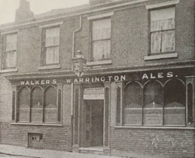
Islington Square was just north of East Ordsall Lane and was considered the posh part of Islington in old Salford, south of Chapel Street and before the rail lines.  In 1865 the Islington Inn was opened by the Sandywell Brewery of Greengate on the corner of Lower Islington Street and the square, and in 1905 Wilsons Brewery bought the beerhouse.  

Islington Inn, Islington Square. (c) Neil Richardson [2].

The Islington Inn only lasted a few more years, as the brewster sessions of 1914 stated that the beerhouse was mainly used by women so the trade was small (but respectable).  It was converted to a shop and lasted until the late 1950s when Islington was redeveloped, and now Rodney Street continues on roughly where Islington Square was.

Former location of Islington Inn, Rodney Street. (c) Google 2013. View Larger Map.
1. Salford's Pubs 2,  Neil Richardson, Tony Flynn, Alan Gall (1978).
2. Salford Pubs Part Two: Including Islington, Ordsall Lane and Ordsall, Oldfield Road, Regent Road and Broughton, Neil Richardson (2003).

Lightbowne, Lightbowne Road

Lightbowne, Lightbowne Road, Moston. (c) Alan Winfield with permission.

The Lightbowne was a huge inter-war estate pub on the corner of Sulby Street and Lightbowne Road in Moston.  It closed a few years ago and was sadly knocked down in 2011 and replaced by the Lightbowne Hall retirement home.  An original Lightbowne Hall (1936) stood on this spot before the pub was built.

Lightbowne, Lightbowne Road. (c) PML Limited.

The Lightbowne was a Whitbread house in the 1990s and offered Boddingtons bitter, which even by then, had started to deteriorate in taste, as the corporate style-over-substance policy kicked in, eventually leading to the death of the ale.  These archive photos from 1968 show the Lightbowne Hotel as a Chesters house, but by 1971 was branded as Whitbread.

Lightbowne, Lightbowne Road. (c) novaloca.

There's a picture of the Lightbowne being knocked down at flickr and Google Maps aerial view shows the pub still there.  The immense size of the boozer and its car park is clue to why these old inter-war pubs are closing at such a rate - they are just too big to support communities that are increasingly disinterested in using pubs.

Lightbowne, Lightbowne Road. (c) Google 2013. View Larger Map.

Former location of the Lightbowne, Lightbowne Road. (c) Google 2013. View Larger Map.

Monday, 21 October 2013

Robin Hood, Queens Road

Robin Hood, Queens Road, Harpurhey. (c) Manchester Local Image Collection. Click here to view full image [1].

Pictured here in 1958, the Robin Hood was a quite grand-looking Cornbrook house in the flat iron style.  As we pass through the years, this Harpurhey boozer on the corner of Scropton Street and Queens Road begins to get more tatty, as in 1971.  The Robin Hood is pictured here in 1981 as a Bass house  (that's the still-serving Milan in the background) and just three years later it closed, having stood here since 1875 [2].  The final picture in 1984 is a sad sight as dereliction kicked in, and the Robin Hood was pulled down soon after.

Former location of Robin Hood, Queens Road. (c) Google 2013. View Larger Map.

2. The Old Pubs of Rochdale Road and neighbourhood Manchester, Bob Potts (1985).

Robin Hood, Droylsden Road

Robin Hood, Droylsden Road, Newton Heath, 2010. (c) David Dixon at geolocation under Creative Commons.

The Robin Hood on Droyslden Road in Newton Heath was a Marstons pub that closed fairly recently, as shown above up for sale in 2010.  These days it's a property letting agent's shop.

Former Robin Hood, Droylsden Road. (c) Google 2013. View Larger Map.

Robin Hood, Droylsden Road, 1984. (c) D.N. at ManMates Facebook [1].

Former Robin Hood, Droylsden Road. (c) Google 2013. View Larger Map.

Saturday, 19 October 2013

New Inn, Ashton New Road

New Inn, Ashton New Road, Beswick. (c) Manchester Local Image Collection. Click here to view full image [1].

The New Inn is shown on the corner of Darley Street and Ashton New Road in 1970, a grand old pub that was left standing whilst all the houses around it were pulled down in the name of redevelopment.  This 1964 photo looking down Darley Street shows the New Inn in the background of the old Beswick terraces.

New Inn, Ashton New Road. (c) Alf Proctor at ManMates [2].

The above drawing of the New Inn by Alf Proctor, a 90-year-old expat living in Australia, depicts the pub in happier times [2].  The old location of the New Inn must have been on the diagonally opposite corner to the Cricketers Rest, which places it on the corner of Mercedes garage entrance in the shadow of City's stadium.

Former location of New Inn, Ashton New Road. (c) Google 2013. View Larger Map.

Thursday, 17 October 2013

Kippax / Gibraltar, Grimshaw Lane

The Kippax, Grimshaw Lane, Newton Heath. (c) David Dixon at geograph under Creative Commons.

The Gibraltar is seen in these two 1964 photos as a Wilsons house on the corner of Bower Street and Grimshaw Lane, just off Oldham Road in Newton Heath.  Pictured more recently below in 1985 thanks to the ManMates Facebook page [1], it was still known as the Gibraltar until Manchester City moved from Moss Side to Bradford in 2003.  The landlord did what a number of pubs around the City of Manchester Stadium did, and changed its name to commemorate the development (or more likely, try to attract match day custom), to the Kippax (after the huge old terrace at Maine Road).

Gibraltar, Grimshaw Lane. (c) D.N. at ManMates Facebook [1].

Like the Church (Blue Moon), Birch Arms (Out of the Blue), Cricketers (The Stadium), Bradford (Guvnors) and Britannia (Summerbee's / Maine Road), the newly renamed Kippax did attract match day customers.  But now, also in common with these pubs, it's now closed down - having done so just before the most recent Manchester derby - City won 4-1 but the Kippax match day regulars will have had to toast the victory elsewhere.  Of the list above, only the old Cricketers/Stadium has survived, and that's as a curry house, though the Crossroads (The Manchester) and the Victoria (Eastlands Bar) are a couple of renamed survivors.

The Kippax, Grimshaw Lane. (c) Google 2013. View Larger Map.

Talbot Inn, Russell Street

Talbot Inn, Russell Street, Hulme, 1950s. (c) Bob Potts [1].

The Talbot Inn opened in 1865 and lasted just shy of a century as it closed in 1963.  It was originally a W. Kay house which passed to Wilsons before it passed.  Standing at No.9 Russell Street which was just off City Road, the old location of the Talbot Inn was lost to the building of Chorlton Road.  The path of Russell Street between City Road and Stretford Road was roughly where Shawgreen Close runs today.

1. The Old Pubs of Hulme and Chorlton-on-Medlock, Bob Potts (1997).

Rob Roy, Vine Street

Rob Roy, Vine Street, Hulme. (c) Bob Potts [1].

The Rob Roy opened in 1853 at No.40 Vine Street [2] on the corner with Warde Street, just south of Stretford Road in Hulme.  It passed from the still surviving Hydes Brewery to Groves & Whitnall but closed in 1966 for the huge-scale redevelopment of Hulme [1].  Pictured above in 1900, the sign advertises 'C Ale', 'close mineral waters' and 'Crown Stout.'  Vine Street was lost to the building of the Princess Road, and the Roy Roy would have been on the left on the approach to the Stretford Road arched bridge.

Former location of Roy Roy, Vine Street. (c) Google 2013. View Larger Map.

The Old Pubs of Hulme and Chorlton-on-Medlock, Bob Potts (1997).

Wednesday, 16 October 2013

Swan Inn, Norman Street

Swan Inn, Norman Street, Harpurhey. (c) Bob Potts [1].

The Swan Inn on Norman Street was nicknamed Jack Crow's after an old landlord, John William Merriweather Crowe who was in charge from 1928 to 1961.  Three years after Crowe left the Swan was granted its full licence.  The Swan opened in 1853 and was still serving on Norman Street, just off Rochdale Road in Harpurhey, in 1985 when Bob Potts wrote his book [1]. 

1. The Old Pubs of Rochdale Road and neighbourhood Manchester, Bob Potts (1985).

Queens Arms, Rudyard Street

Queens Arms, Rudyard Street, Harpurhey. (c) Bob Potts [1].

Pictured above in 1961, the Queens Arms stood on Rudyard Street off Queens Road and Harpurhey and was nicknamed the 'Little Queens'.  It opneed in 1867 and was firstly a Walker & Homfrays house before closing in 1969 as a Wilsons house [1].  The Manchester Communication Academy sits on the old location of Rudyard Street and the Queens Arms.

1. The Old Pubs of Rochdale Road and neighbourhood Manchester, Bob Potts (1985).

Bulls Head / Clifton Arms / Pollards Arms, Hampson Street

Bulls Head, Hampson Street, Islington, Salford. (c) Neil Richardson [1]

The Bulls Head on the corner of Nangreave Street and Hampson Street was an old Threlfalls pub that is said to have had its own ghost [2].  It can be traced back to 1829 as the Pollards Arms public house and by 1845 it had changed its name to the Clifton Arms [1].

Bulls Head, Hampson Street. (c) Neil Richardson, Tony Flynn, Alan Gall [2].

The Clifton Arms was soon renamed the Bulls Head and by the 1870s was a Threlfalls house.  They were one of the local brewers who wanted to open the new hotel in Weaste in the 1920s, and they were eventually successful when, in 1929, they were granted permission to transfer the Bulls Head licence (and 7 other licences) to the Weaste Hotel on Edward Avenue [1].

Former location of Bulls Head, Hampson Street. (c) Goole 2013. View Larger Map.

1. Salford Pus Part Two: Including Islington, Ordsall Lane and Ordsall, Oldfield Road, Regent Road and Broughton, Neil Richardson (2003).
2. Salford's Pubs 2, Neil Richardson, Tony Flynn, Alan Gall (1978).

Monday, 14 October 2013

Mitchell Arms, Every Street

Mitchell Arms, Every Street, Ancoats. (c) Gerald England at geograph under Creative Commons.

Like the Pomona Palace over on the other side of town, the Mitchell Arms has recently closed despite its decent match day trade from the Eastlands crowds.  Owners, the hapless, hopeless and horrible Punch Taverns, have been trying to flog it off for years and this season has seen it finally boarded up, seemingly for good.  It's been for sale for £195k with the estate agents urging alternative usage [1], such is the ruinous policy of the despicable large pub companies.

Mitchell Arms, Every Street. (c) Jenics.

The Mitchell Arms was a shabby old pub, offering little in the way of decent beer (keg Banks's or Guinness was usually the option), but as a match day pub it served its purpose and we used it a number of times over the years.  One midweek night game saw a lock-in with the landlord ordering takeaway curry for participants.  As a community boozer, it never looked particularly busy but this part of Ancoats isn't particularly well-pubbed (though the Bank of England has again reopened).

Mitchell Arms, Every Street. (c) Jenics.

It's odd that the pub has closed almost as soon as the new tram stop opened, bringing potentially more customers here on match days and maybe at other times too.  I've always wondered whether Joseph Holt's would see the potential of taking over a boozer at the Holt Town tram stop (answer: no).  Sadly, at least 180 years of history has been consigned to the dustbin.

Mitchell Arms, Every Street, 1950s. (c) Neil Richardson [3].

The Mitchell Arms stands on Every Street bound by Merrill (once Mitchell) Street, Beswick Street, Frost Street and Holt Town, and it started out as a beerhouse.  However, it was fully licensed by the 1840s, it's been owned by the Pollard Street Brewery, Walker & Homfrays, Wilsons and then Banks's [3].  Some proud old breweries there, before Punch Taverns did their thing.

Mitchell Arms, Every Street. (c) Gerald England at geograph under Creative Commons.

3. The Old Pubs of Ancoats, Neil Richardson (1987).

Queens Arms, Regent Road

Queens Arms, Regent Road, Salford. (c) Neil Richardson, Tony Flynn, Alan Gall [1].

The Queens Arms or the 'Big Queens' was the original Threlfalls house that the Two Brewers estate pub replaced in 1963.  The landlord of the Queens walked from his old pub to his new one on the 8th of May 1963 - the estate pub was built next door to the Queens before its demolition.  The Queens Arms was built in the 1830s on the corner of West Cross Street and Regent Road, licensed in 1836 and passing to Threlfalls by the 1870s.  The merger of Threlfalls with Chesters Brewery gave the replacement estate pub its name [2].  Their location was on the north side of Regent Road, equidistant betwixt Oldfield Road and Ordsall Lane.

1. Salford's Pubs 2, Neil Richardson, Tony Flynn, Alan Gall (1978).
2. Salford Pubs Part Two: Including Islington, Ordsall Lane and Ordsall, Oldfield Road, Regent Road and Broughton, Neil Richardson (2003).

Royal Jubilee, Duke Street

Royal Jubilee, Duke Street, Hulme. (c) Bob Potts [1].

The Royal Jubilee stood at at no.81 Duke Street off Stretford Road, opening in 1885 [2] and closing in 1936 [1].  It passed from the surviving J W Lees brewery to the long-gone Peter Walker & Son brewers of Warrington [2].  Duke Street was lost to the Princess Parkway (Princess Road) and the Royal Jubilee used to stand in the shadow of the lovely Hulme arch.

Former location of Royal Jubilee, Princess Road. (c) Google 2013. View Larger Map.

1. The Old Pubs of Hulme & Chorlton-on-Medlock, Bob Potts (1997).
2. The Old Pubs of Hulme Manchester (1) 1770-1930, Bob Potts (1983).

Burton House, Burton Street

Burton House, Burton Street, Collyhurst. (c) Bob Potts [1].

The Burton House was a fairly short-lived beerhouse on Burton Street, off Dalton Street, in a part of south-western Collyhurst which was known as Newtown.  The Burton House opened in 1869 and closed in 1913 as an Empress Brewery house at No.36 Burton Street.  Burton Street has disappeared from the maps but it still runs off Dalton Street today and forms part of a business car park.

Former location of Burton Street. (c) Google 2013. View Larger Map.

1. The Old Pubs of Rochdale Road and neighbourhood Manchester, Bob Potts (1985).

Friendship, Consterdine Street

Friendship, Consterdine Street, Monsall. (c) Bob Potts [1].

Consterdine Street used to run for a short length, parallel to Queens Road at the bottom of Monsall Street, and it boasted two beerhouses.  The Bakers Arms was the last to close in 1936 but the first to open was the Friendship, which served from 1851 to 1930.  It was a Walkers of Warrington house at No.14 Consterdine Street, a road which has since been replaced by Foreland Close since redevelopment of Monsall.

1. The Old Pubs of Rochdale Road and neighbourhood Manchester, Bob Potts (1985).

Sunday, 13 October 2013

Duke of York, Bury Street

Duke of York, Bury Street, Salford. (c) Neil Richardson, Tony Flynn & Alan Gall [1].

The Duke of York stood on the corner of Frederick Street and Bury Street in old Salford, opening in 1825 and passing into the hands of Watson & Woodward's brewery towards the end of the century.  The brewery bought up the house next door and later alterations included a new back entry and conversion of the upstairs clubroom into bedrooms.  The Duke of York passed to Walker & Homfrays then Wilsons after WWII.  Although the pub was included in the area for post-war redevelopment, it lasted until the mid-1960s, serving the new flats and maisonettes for a few brief years before it was pulled down [2].  Frederick Street and Bury Street still partially run through Salford today but they don't quite meet anymore; the old location of the Duke of York being where Nathan Drive bends.

1. Salford's Pubs 2, Neil Richardson, Tony Flynn & Alan Gall (1978).
2.  Salford Pubs Part One: The Old Town, including Chapel Street, Greengate and the Adelphi, Neil Richardson (2003).

Fox Tavern, Bury Street

Fox Tavern, Bury Street, Salford. (c) Neil Richardson, Tony Flynn & Alan Gall [1].

The Fox Tavern can be traced back to about 1850 when a beer house was opened on the corner of Garden Lane and Bury Street.  In 1893 the Cornbrook Brewery owned the Fox and extended it into neighbouring properties, with beautiful decorative stonework commemorating the rebuild.  At the brewster sessions the landlord claimed the Fox had been licensed for 200 years, though a magistrate remembered it being a greengrocer's before a beerhouse.  The new Fox only stayed open until 1913 when it closed due to lack of trade.  The building became a lodging house and survived into the 1950s with 'The Old Original Fox Tavern' stonework still maintained [2].

Former location of Fox Tavern, Bury Street. (c) Google 2013. View Larger Map.

1. Salford's Pubs 2, Neil Richardson, Tony Flynn & Alan Gall (1978).
2.  Salford Pubs Part One: The Old Town, including Chapel Street, Greengate and the Adelphi, Neil Richardson (2003).

Saturday, 5 October 2013

Mechanics Rest, Chester Street

Mechanics Rest, Chester Street, Hulme. (c) Bob Potts [1].

The Mechanics Rest served at number 84 Chester Street from 1846 to 1927, owned by the Walker & Son brewery of Warrington [1].  Chester Street used to run from Great Jackson Street to Oxford Road, and today it still runs from Oxford Road over to Newcastle Street, boasting a new development of restaurants and the Courtyard further down.

1. The Old Pubs of Hulme Manchester (1) 1770-1930, Bob Potts (1983).

Britannia Inn, Upper Jackson Street

Britannia Inn, Upper Jackson Street, Hulme (c) Bob Potts [1].

The Britannia Inn was first licensed in 1861 and was a Greatorex Brothers house.  This brewery were once based at the Queens Brewery, Moss Side, where Hydes Brewery have just moved from, to Salford.  The Britannia stood on the corner of Naylor Street and Upper Jackson Street, just south of Stretford Road, where Old Birley Street runs today.  From Greatorex it passed to the Empress Brewery and then Peter Walker & Son of Warrington, before it closed in 1966 for Hulme's redevelopment [2].

1. The Old Pubs of Hulme Manchester (1) 1770-1930, Bob Potts (1983).
2. The Old Pubs of Hulme and Chorlton-on-Medlock, Bob Potts (1997).